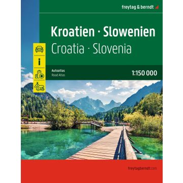
Kroatien - Slowenien, Autoatlas 1:150.000, freytag & berndt
Straßenatlas mit Spiralbindung
€29.90
incl. VAT
in stock
Delivery in 2 to 4 business days
Tags
Autoatlas Kroatien - Slowenien 1:150.000Informationen zum Straßenatlas Kroatien - Slowenien
Verdeckte Spiralbindung
Innenstadtpläne
- Kroatien - Slowenien 1:150.000
- Europa 1:3.500.000
- Spiralbindung verdeckt
- Camping- und Stellplätze
- Touristische Informationen
- Ortsregister mit Postleitzahlen
- 19 Innenstadtpläne
- 224 Seiten, Format 23 x 29,7 cm
Verdeckte Spiralbindung
Innenstadtpläne
Weight:
658 g
Publisher:
Scale:
1:150000
Product Type:
Maps
EAN:
9783707924633
hoehe_mm:
297
breite_mm:
230
Year of publication:
2026
Write Your Own Review
Manufacturer
Name: KOMPASS Karten
Address: Karl-Kapferer-Str. 5, 6020 Innsbruck, Österreich
Email: info@kompass.at
Phone: +43 512 265561-10
Responsible for the EU
Name:
Address:
Email:
Phone:
Hazard warning: nicht erforderlich.
Product Type: