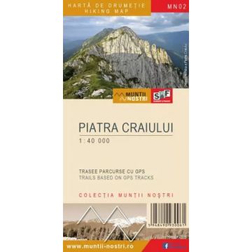
Wanderkarte MN-02, Piatra Craiului 1:40.000
Südkarpaten
€9.90
incl. VAT
currently out of stock
Delivery in 8 to 14 business days
Tags
The Piatra Craiului Mountains, or just Crai, is a limestone mountain range to the southwest of the Eastern Carpathians, being part of the Southern Carpathians, located in their northeastern part.
The geology and geomorphology of the massif differs from that of the surrounding mountains, which consist almost entirely of crystalline rocks, the "Crai" being a sharp and steep "blade" composed of metamorphic rocks, mainly Jurassic limestone, approximately 24 to 26 km long, with a southwest-northeast orientation, and 6 to 8 km wide. Its famous vertical walls, 400-650 m high, are the result of the horizontally layered limestone. The highest point of the massif is La Om Peak, also known as Piscul Baciului, 2,238 m. There are many peaks over 2,000 meters: Padina Popii Peak (2,018 m), Ascutit Peak (2,150 m), Timbalul Mare Peak (2,177 m), Varful dintre Timbale Peak (2,170 m), Sbirii Peak (2,220 m), Caldarea Ocolita Peak (2,202 m).
Dambovicioara Gorge and Dambovicioara Cave are the most important karst phenomena in Piatra Craiului Mountains. Zarnesti Gorge, Botorog Fountain, La Zaplaz, Cerdacul Stanciului, Stanciului Cave, the Devil's Mill are other spectacular landforms in the northeastern part of the massif. Another karst formation to be mentioned is Marele Grohotis (The Great Scree), a 4 km-long unstable collection of rock fragments.
Piatra Craiului Nature Reserve was established in 1938, covering more than 1,200 hectares of the massif.
The map of Piatra Craiului Mountains (MN02) is the 2nd map of the new Muntii Nostri collection.
The map was edited using the latest mapping techniques and it was printed on moisture resistant paper. It is easy to read and simple to use due to the mapping styles, specific to Schubert & Franzke company, and as a result of practical information structuring. It is handy and everything is exactly where it should be. The map is useful for both hiking enthusiasts and professionals.
All the trails have been recorded in the field using a GPS. They are described in detail in both Romanian and English. Each trail has a technical box containing with necessary information. The map also contains the UTM grid, a projected coordinate metric system useful in the quick measurement of distances on the map.
Weight:
57 g
Publisher:
Series:
Scale:
1:40.000
Product Type:
Maps
Language:
English, Romanian
EAN:
5948490930658
Year of publication:
2023
Write Your Own Review
Manufacturer
Name:
Address:
Email:
Phone:
Responsible for the EU
Name:
Address:
Email:
Phone:
Hazard warning:
Product Type: