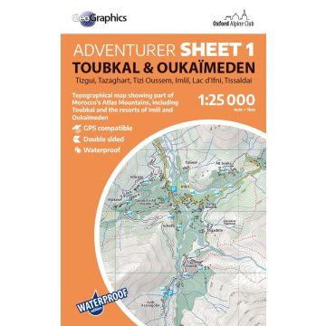
OAC Adventure Sheet 1, Toubkal & Oukaïmeden 1:25.000
Hoher Atlas
€24.90
incl. VAT
in stock
Delivery in 2 to 4 business days
Tags
Tizgui, Tazaghart, Tizi Oussem, Imlil, Lac d'Ifni, Tissaldai
Waterproof 1:25.000 scale topographical map
Printed on ultra-tough, waterproof, tearproof PolyArt paper, this 1:25.000 Adventurer Map is perfect for mountaineers, climbers and trekkers exploring Morocco's High Atlas mountains.
This double-sided sheet covers the popular part of the Atlas Mountains around Imlil, including the summits of Toubkal, Tazaghart, Timesquida, Annrhemer and Adrar N’Dern, as well as the valley bases of Tizi Oussem, Imlil, Oukaïmeden and Tassaldai.
Fully updated for 2025, this is the clearest mapping ever created for this region and will be a superb resource for anyone looking to climb or walk in the mountains around Toubkal.
Weight:
65 g
Publisher:
Series:
Scale:
1:25.000
Product Type:
Maps
Language:
English
EAN:
9781913167219
Year of publication:
2025
Continent: Africa
Country: Morocco
Region: hoher atlas
Places / Mountains / Lakes: Imlil, Djebel Ouanoukrim, Oukaimeden, Lac d'Ifni, Tizgui, Aksoual, toubkal
Write Your Own Review
Manufacturer
Name:
Address:
Email:
Phone:
Responsible for the EU
Name:
Address:
Email:
Phone:
Hazard warning:
Product Type: