The store will not work correctly when cookies are disabled.
JavaScript seems to be disabled in your browser. For the best experience on our site, be sure to turn on Javascript in your browser.
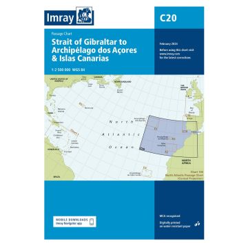
Imray Seekarte C20 - Strait of Gibraltar to Archipélago dos Açores & Islas Canarias 1:2.500.000 Imray Seekarte C20 - Strait of Gibraltar to Archipélago dos Açores & Islas Canarias 1:2.500.000
Passage Chart, 1:2.500.000
Imray Seekarte C20 - Strait of Gibraltar to Archipélago dos Açores & Islas Canarias 1:2.500.000 Passage Chart, 1:2.500.000
€37.90
incl. VAT
in stock
Delivery in 2 to 4 business days
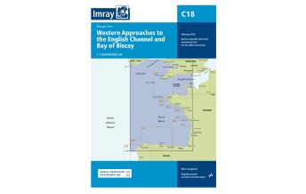
More from series: Imray C Series Please select C1 Thames Estuary, Imray Chart C14 Plymouth Harbour and Rivers, Imray Chart C2 The River Thames, Imray Chart C27 Firth of Forth, Imray Chart C28 Harwich to Wells-next-the-Sea, Imray Chart C34 Cap d'Erquy to Ile de Batz, Imray Chart C35 Baie de Morlaix to L'Aber-Ildut, Imray Chart C4 Christchurch to Portland Bill, Imray Chart C5 Portland Bill to Salcombe Harbour, Imray Chart C51 Cardigan Bay, Imray Chart C58 Trevose Head to Bull Point, Imray Chart C59 Bristol Channel, Imray Chart C6 Salcombe to Lizard Point, Imray Chart C60 Gower Peninsula to Cardigan, Imray Chart C69 Loch Ryan to Belfast Lough and Strangford Lough, Imray Chart C7 Falmouth to Isles of Scilly and Trevose Head, Imray Chart C8 Dover Strait, Imray Chart C9 Beachy Head to Isle of Wight, Imray Chart Harwich to Hoek van Holland and Dover Strait 1:200.000 Harwich to Whitby 1:285.000 Imray C37 Seekarte - Raz de Sein to Benode 1:80.000 IMRAY Chart C23 - Fife Ness to Moray Firth 1:250,000 Imray Chart C26, IJmuiden to Die Elbe 1:345.000 IMRAY Chart C40 - Le Croisic to Les Sables d'Olonne 1:110.000 IMRAY Chart C41 - Les Sables d'Olonne to La Gironde 1:110.000 IMRAY Chart C49 - Ria de Aveiro to Sines 1:350.000 IMRAY Chart C61 - St George's Channel 1:280.000 IMRAY Chart C62 - Irish Sea 1:280.000 Imray Seekarte C18 - Western Approaches to the English Channel & Bay of Biscay 1:1.000.000 Imray Seekarte C32 - Baie de Seine 1:155.000 Imray Seekarte C42 - La Rochelle to Santander 1:350.000 Imray Seekarte C48 - A Coruna to Porto 1:350.000 Imray Seekarte C80 - British Isles 1:1.500.000 Imray Seekarte Chart C36 Frankreich- Île d'Ouessant to Raz de Seine 1:80.000 Imray Seekarte Schottland - C65 Crinan to Mallaig and Barra 1:155.000 Southern North Sea Passage Chart 1:900.000 The Solent Tags Spanien Kanarische Inseln Marokko Portugal Seekarte Canarias Madeira Açores nautical Chart Azoren übersegler Passage Chart Approach Mooring
Manufacturer Name: FB Imray Laurie Norie & Wilson GmbH
Address: Ölzeltgasse 3/10, 1030 Wien, Österreich
Phone:
Responsible for the EU Name:
Address:
Email:
Phone:
No manufacturer information and safety instructions available yet. Other customers also bought
Follow us
4.9 based on 1515 reviews
Payment
Reviews
If you are a reseller, please contact our
Wholesale departement directly.
Austria + Germany T.
+43-1-869 90 90-800 sales.at@freytagberndt.com
When ordering through our webshop, end-customer prices are applied and a subsequent correction is unfortunately not possible.
freytag & berndt Sales Team