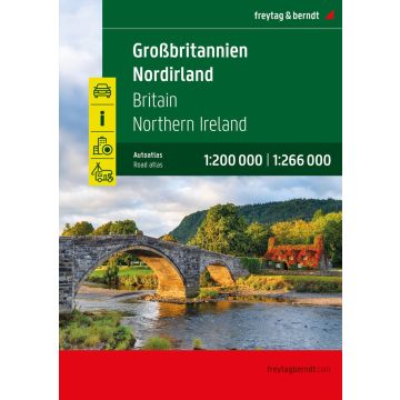
Großbritannien - Nordirland, Autoatlas 1:200.000 - 1:266.000, freytag & berndt
Straßenatlas mit Spiralbindung, Camping- und Stellplätze, Freizeitinfos
€24.90
incl. VAT
in stock
Delivery in 4 to 7 business days
Tags
Autoatlas Großbritannien - Nordirland 1:200.000 - 1:266.000Informationen zum Straßenatlas Großbritannien - Nordirland
Spiralbindung
Innenstadtpläne
- Großbritannien - Nordirland 1:200.000 - 1:266.000
- Spiralbindung
- Camping- und Stellplätze
- Touristische Informationen
- Ortsregister
- 64 Innenstadtpläne
- 328 Seiten, Format 22,5 x 29,7 cm
Spiralbindung
Innenstadtpläne
Weight:
990 g
Publisher:
Scale:
1:200000
EAN:
9783707924084
hoehe_mm:
300
breite_mm:
225
Year of publication:
2025
Continent: Europe
Country: United Kingdom (Great Britain)
State / Province: Northern Ireland
Region: Ulster
Write Your Own Review
Manufacturer
Name: FREYTAG-BERNDT und ARTARIA KG
Address: Ölzeltgasse 3/10, 1030 Wien, Österreich
Email: office@freytagberndt.com
Phone: +43 512 265561-10
Responsible for the EU
Name:
Address:
Email:
Phone:
Hazard warning: Dieser Hinweis kann lt. Artikel 9 Absatz 7 Satz 2 der GPSR entfallen, da das Produkt auch ohne Anweisungen und Sicherheitsinformationen sicher und wie vom Hersteller vorgesehen verwendet werden kann.
Product Type: