Editorial Alpina Map & Guide E-30, Carlit, Bollosa 1:30.000
östliche Pyrenäen
€14.90
incl. VAT
currently out of stock
Delivery in 3 to 4 weeks
Tags
Alta Cerdanya, Capcir, Arieja
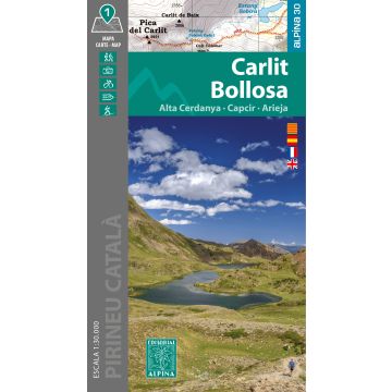
Map & Folder - Catalan / Spanish / English / French El ámbito del mapa abarca una zona entre la Alta Cerdaña, el Capcir y el Ariège, un entorno privilegiado para el excursionismo con paisajes de alta montaña impresionantes. Destacan cumbres emblemáticas como el Carlit (2.921 m) y el Puig Peric (2.810 m), así como extensas zonas lacustres formadas por lagos de origen glaciar.
Map & Folder - Catalan / Spanish / English / French El ámbito del mapa abarca una zona entre la Alta Cerdaña, el Capcir y el Ariège, un entorno privilegiado para el excursionismo con paisajes de alta montaña impresionantes. Destacan cumbres emblemáticas como el Carlit (2.921 m) y el Puig Peric (2.810 m), así como extensas zonas lacustres formadas por lagos de origen glaciar.
- Hiking map and folder
- Scale 1:30.000
- Equidistance contours: 10 m distance
- Master contours: at 50 m
- Shady relief
- Compatible with GPS
- Marked routes
- Land use symbolized at three levels
Publisher:
Series:
Scale:
1:30.000
Product Type:
Maps
Language:
Catalan, English, French, Spanish
EAN:
9788470111709
hoehe_mm:
200
breite_mm:
110
Year of publication:
2025
Continent: Europe
Country: France
State / Province: Occitany
Places / Mountains / Lakes: Pic Carlit, Capcir
Write Your Own Review
Manufacturer
Name:
Address:
Email:
Phone:
Responsible for the EU
Name:
Address:
Email:
Phone:
Hazard warning:
Product Type: