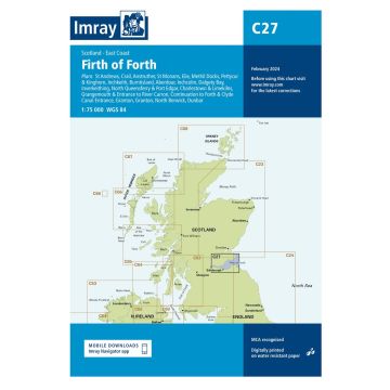
C27 Firth of Forth, Imray Chart
1:75.000
€37.90
incl. VAT
in stock
Delivery in 2 to 4 business days
Tags
Plans included: St Andrews (1:7500) Crail (1:7500) Anstruther (1:7500) St Monans (1:7500) Elie (1:10 000) Methil Docks (1:11 000) Pettycur & Kinghorn (1:17 500) Inchkeith (1:25 000) Burntisland (1:20 000) Aberdour (1:12 500) Inchcolm (1:15 000) Dalgety Bay (1:15 000) Inverkeithing (1:15 000) North Queensferry & Port Edgar (1:20 000) Charlestown & Limekilns (1:15 000) Grangemouth & Entrance to River Carron (1:17 500) Continuation to Forth & Clyde Canal Entrance (1:17 500) Granton (1:12 500) Fisherrow (1:12 500) North Berwick (1:7500) Dunbar (1:7500) On this edition the chart specification has been improved to show coloured light flashes. Depths have been updated from the latest surveys where available. Additional tidal stream Digital has been added. There has been general updating throughout.
Weight:
153 g
Publisher:
Series:
Scale:
1:75.000
Product Type:
Seekarten - gefaltet
Language:
English
EAN:
9781786790590
hoehe_mm:
297
breite_mm:
210
Year of publication:
2018
Continent: Europe
Country: United Kingdom (Great Britain)
State / Province: Scotland
Region: Schottische Nordseeküste, Firth of Forth
Write Your Own Review
Manufacturer
Name: FB Imray Laurie Norie & Wilson GmbH
Address: Ölzeltgasse 3/10, 1030 Wien, Österreich
Email: sales@imray.com
Phone:
Responsible for the EU
Name:
Address:
Email:
Phone:
Hazard warning:
Product Type: