The store will not work correctly when cookies are disabled.
JavaScript seems to be disabled in your browser. For the best experience on our site, be sure to turn on Javascript in your browser.
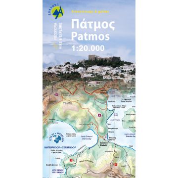
Anavasi Topo Island Map 10.39, Pátmos 1:20.000 Anavasi Topo Island Map 10.39, Pátmos 1:20.000
Anavasi Topo Island Map 10.39, Pátmos 1:20.000 €8.90
incl. VAT
currently out of stock
Delivery in 8 to 14 business days
More from series: Anavasi Topo Islands Please select Anavasi Topo Island Map 10.00, Aígina/Ägina 1:25.000 Anavasi Topo Island Map 10.11, Skiáthos 1:25.000 Anavasi Topo Island Map 10.20, Tínos 1:25.000 Anavasi Topo Island Map 10.21, Ándros 1:27.000 Anavasi Topo Island Map 10.23, Páros, Antíparos 1:40.000 Anavasi Topo Island Map 10.24, Santoríni, Thirasía 1:25.000 Anavasi Topo Island Map 10.26, Sífnos 1:25.000 Anavasi Topo Island Map 10.27, Amorgós 1:32.000 Anavasi Topo Island Map 10.28, Náxos 1:40.000 Anavasi Topo Island Map 10.29, Síkinos 1:25.000 Anavasi Topo Island Map 10.30, Lémnos 1:60.000 Anavasi Topo Island Map 10.33, Chálki 1:20.000 Anavasi Topo Island Map 10.34, Nísyros 1:15.000 Anavasi Topo Island Map 10.36, Lesser Cyclades/Kleine Kykladen 1:25.000 Anavasi Topo Island Map 10.38, Rhodes/Ródos/Rhodos 1:75.000 Anavasi Topo Island Map 10.40, Hydra 1:25.000 Anavasi Topo Island Map 10.41, Kéa/Tziá 1:25.000 Anavasi Topo Island Map 10.42, Délos, Mýkonos, Rheneia/Rínia 1:25.000 Anavasi Topo Island Map 10.43, Spétses 1:12.500 Anavasi Topo Island Map 10.44, Kýthnos 1:31.000 Anavasi Topo Island Map 10.45, Mílos, Kímolos, Polýegos/Polyaigos 1:32.000 Anavasi Topo Island Map 10.46, Folégandros 1:18.000 Anavasi Topo Island Map 10.47, Anáfi 1:18.000 Anavasi Topo Island Map 10.49, Astypálaia 1:35.000 Anavasi Topo Island Map 10.50, Kárpathos, Saría 1:43.000 Anavasi Topo Island Map 10.51, Ikaria 1:35.000 Anavasi Topo Island Map 10.52, Sámos 1:70.000 Anavasi Topo Island Map 10.53, Lésvos / Lesbos 1:70.000 Anavasi Topo Island Map 11.20, Gávdos 1:20.000 Anavasi Topo Island Map 7.1, Thásos/Thassos 1:36.000 Anavasi Topo Island Map 9.2, Alónnisos/Alonisos 1:30.000 Anavasi Topo Island Map 9.2, Paxós, Antípaxos 1:17.000 Anavasi Topo Island Map 9.3, Cephalonia/Kefaloniá, Ithaca/Itháki/Ithaka 1:65.000/1:25.000 Anavasi Topo Island Map 9.4, Corfu/Korfu 1:40.000 Anavasi Topo Islands 10.14, Skýros 1:40.000 Anavasi Topo Islands 10.22, Sýros 1:25.000 Anavasi Topo Islands 10.25, Sérifos 1:20.000 Tags Karte Map Mittelmeer Hiking Wandern topografisch Wanderkarte Outdoor greece Griechische Insel Inselkarte PolyArt
Manufacturer Name:
Address:
Email:
Phone:
Responsible for the EU Name:
Address:
Email:
Phone:
No manufacturer information and safety instructions available yet.
Follow us
4.9 based on 1519 reviews
Payment
Reviews
If you are a reseller, please contact our
Wholesale departement directly.
Austria + Germany T.
+43-1-869 90 90-800 sales.at@freytagberndt.com
When ordering through our webshop, end-customer prices are applied and a subsequent correction is unfortunately not possible.
freytag & berndt Sales Team