The store will not work correctly when cookies are disabled.
JavaScript scheint in Ihrem Browser deaktiviert zu sein. Um unsere Website in bester Weise zu erfahren, aktivieren Sie Javascript in Ihrem Browser.
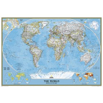
World Classic laminated 1:24.031.000 World Classic laminated 1:24.031.000
World Classic laminated 1:24.031.000 € 54,90
inkl. MwSt.
derzeit nicht auf Lager
Lieferung in 7 bis 14 Werktagen
Mehr aus der Reihe: National Geographic Map Bitte wählen Sie Africa Classic 1:14.244.000 Alaska laminated 1:3.660.000 Alta Via delle Cinque Terre e Alta Via del Golfo 1:25.000 America South 1:11.121.000 Europe classic 1:8.425.000 Europe Executive 1:8.425.000 Greece/Griechenland Classic 1:1.491.000 Il Devoto Cammino dei Sacri Monti Laugavegur Trail 1:25.000 NG Kartenheft 4001, Haute Route 1:50.000 NG Kartenheft 4002, Camino de Santiago - Camino Francés 1:50.000 NG Kartenheft 4003, Camino de Santiago - Camino Francés 1:50.000 NG Kartenheft 4004, Camino de Santiago - Camino Francés 1:50.000 NG Kartenheft 4005, Camino de Santiago - Camino Francés 1:50.000 NG Kartenheft 4006, Cinque Terre 1:50.000 NG Kartenheft 4007, Dolomite High Route - Alta Via 1, 1:50.000 NG Kartenheft 4009, Hadrian's Wall Path 1:25.000 NG Kartenheft 4010, Tour du Mont Blanc 1:50.000 NG Kartenheft Milford Track, Routeburn Track, Kepler Track NG Map Pack Camino de Santiago - Camino Francés 1:50.000 North America Classic laminated 1:8.950.000 Trekking delle Torri Costiere in Salento, Teil 1 USA Explorer laminated 1:6.396.000 Wall Map Wandkarte World Executive 1:22.445.000 Weltkarte World Political Antique (Executive) 1:36.384.000 World Classic - Pacific Centered laminated 1:36.384.000 World Classic Mural 1:15.267.000 World physical Ocean Floor 1:24.031.000 World physical Ocean Floor laminated 1:45.500.000 World political 1:22.445.000 Tags aufhängen plano Planokarte Planokarten Poster posterkarte Wall Map wallmap Wandkarte Wandplan Weltkarte Landkarte Weltkarten (Papeterie)
Schreibe deine eigene Bewertung Hersteller Name:
Adresse:
E-Mail-Adresse:
Telefonnummer:
Verantwortlich für die EU Name:
Adresse:
E-Mail-Adresse:
Telefonnummer:
Noch keine Herstellerangaben und Sicherheitshinweise verfügbar.
Folge uns
4,9 basierend auf 1515 Bewertungen
Zahlungsarten
Kundenbewertungen
Falls Sie Wiederverkäufer sind bestellen Sie bitte direkt über unsere Auslieferung damit wir ihre Konditionen berücksichtigen können:Österreich + Deutschland +43-1-869 90 90-800 sales.at@freytagberndt.com
Bei Bestellung über unseren Webshop kommen ausschließlich Endkundenpreise zur Anwendung und eine nachträgliche Korrektur ist leider nicht möglich.
Ihr Team von freytag & berndt