Wanderkarte Toubkal & Marrakech 1:50.000
€ 12,90
inkl. MwSt.
lieferbar
Lieferung in 1 bis 4 Werktagen
Tags
Carte de randonnées - hiking map - mapa excursionista - Wanderkarte
waterproof
Auflage: 2018
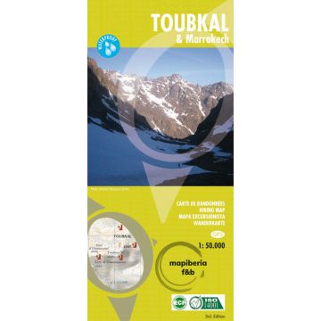
A detailed, accurate and up-to-date trekking map of Jebel Toubkal in the High Atlas mountains of Morocco, the highest peak in North Africa and a popular trekking destination. The 1:50,000 topographic map detail includes contours at 20m intervals, hill-shading, woodland and scrub areas, springs, creeks, rivers and dry riverbeds.
A detailed, accurate and up-to-date trekking map of Jebel Toubkal in the High Atlas mountains of Morocco, the highest peak in North Africa and a popular trekking destination. The 1:50,000 topographic map detail includes contours at 20m intervals, hill-shading, woodland and scrub areas, springs, creeks, rivers and dry riverbeds.
Road detail includes tracks and footpaths, and funicular railways and ski-lifts are also indicated. Isolated buildings are marked and symbols show ski-stations, refuges and religious buildings.
On the reverse is a clear plan of Marrakech at approximately 1:8,700.
Gewicht:
106 g
Verlag:
Maßstab:
1:50.000
Medienart:
Karten
EAN:
9788493560003
Erscheinungsjahr:
2018
Kontinent: Afrika
Land: Marokko
Region: hoher atlas
Orte / Berge / Seen: Marrakesch, Imlil, Djebel Ouanoukrim, Oukaimeden, Lac d'Ifni, Tizgui, Amsourzerte, toubkal
Schreibe deine eigene Bewertung
Hersteller
Name:
Adresse:
E-Mail-Adresse:
Telefonnummer:
Verantwortlich für die EU
Name:
Adresse:
E-Mail-Adresse:
Telefonnummer:
Gefahrenhinweis:
Produktart: