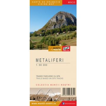
Wanderkarte MN-30, Metaliferi 1:90.000
Rumänische Westkarpaten
€ 9,90
inkl. MwSt.
derzeit nicht auf Lager
Lieferung in 7 bis 14 Werktagen
Tags
The Metaliferi Mountains are bordered to the north by the Codru Moma Mountains, the Bihor Mountains and the Gilau-Muntele Mare Mountains by Crisul Alb River, Brad Depression, Buces-Vulcan Pass, Cernita Valley, Abrud River, and Aries River; to the east by the Trascau Mountains through a multitude of valleys, here the boundary between the two mountains is on a geological basis, then by Ampoi Valley, and finally Secaselor Plateau; to the south by Orastie Corridor, from the Poiana Rusca Mountains through Mures Valley; to the west by the Zarand Mountains through Dumbravita River, Grosului Valley, Socilor Valley, Slatina-Madrigesti Passs, and Sedisorului River.
The Metaliferi Mountains are mostly made up of strongly fragmented volcanic rocks, with intercalations of calcareous rocks, therefore the lanscape is chaotic, where volcanic clays alternate with pyramids and calcareous gorge sections and wide valleys. The maximum elevation of the massif does not exceed 1,500 meters, the highest peaks are: Poienita Peak 1,437 m, Ferigilor Peak 1,377 m, and Zmida Peak 1,376 m.
Due to the chaotic landscape of the Metalliferi Mountains, there are many touristic attractions: the basalt columns from Detunata Goala; Mada Gorge, Glod Gorge, Cib Gorge; and last but not least, it is worth visiting Rosia Montana, where the Mining Museum and the Roman Galleries are located, and a lot of tourist trails can be done in the area.
The map of Metaliferi Mountains (MN30) is the 30th map of the new Muntii Nostri collection.
The map was edited using the latest mapping techniques and it was printed on moisture resistant paper. It is easy to read and simple to use due to the mapping styles, specific to Schubert & Franzke company, and as a result of practical information structuring. It is handy and everything is exactly where it should be. The map is useful for both hiking enthusiasts and professionals.
All the trails have been recorded in the field using a GPS. They are described in detail in both Romanian and English. Each trail has a technical box containing with necessary information. The map also contains the UTM grid, a projected coordinate metric system useful in the quick measurement of distances on the map.
Gewicht:
74 g
Reihe:
Maßstab:
1:90.000
Medienart:
Karten
Sprache:
Englisch, Rumänisch
EAN:
5948490930641
Erscheinungsjahr:
2023
Schreibe deine eigene Bewertung
Hersteller
Name:
Adresse:
E-Mail-Adresse:
Telefonnummer:
Verantwortlich für die EU
Name:
Adresse:
E-Mail-Adresse:
Telefonnummer:
Gefahrenhinweis:
Produktart: