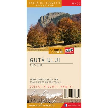
Wanderkarte MN-20, Gutâiului 1:25.000
Maramuresch
€ 9,90
inkl. MwSt.
derzeit nicht auf Lager
Lieferung in 8 bis 14 Werktagen
Tags
The Gutai Mountains in the Eastern Carpathians are bounded on the west by the Ignis Mountains through Rausor Valley, Gutai Pass and Sasar brook, on the north by Maramures Depression, on the east by Lapus Mountains through Oanta brook, Neteda Pass and Cavnic brook, and on the south by Baia Mare Depression.
Geologically, the Gutai Mountains consist of igneous rocks from the Neogene Period. The highest peaks are Gutai (1,443 m), Gutaiul Doamnei (1,424 m) and Gutaiul Mic (1,398 m).
The biggest tourist attraction of the massif is Creasta Cocosului Nature Reserve. It is a sharp, castellated ridge from a former volcanic crater about 200 m in length, situated at an average elevation of 1,200 m, with northwest-southeast orientation. The reserve, which is also a monument of nature, aims to protect and preserve the natural elements of particular ecological, scientific and landscape significance.
The map of Gutaiului Mountains (MN20) is the 20th map of the new Muntii Nostri collection.
The map was edited using the latest mapping techniques and it was printed on moisture resistant paper. It is easy to read and simple to use due to the mapping styles, specific to Schubert & Franzke company, and as a result of practical information structuring. It is handy and everything is exactly where it should be. The map is useful for both hiking enthusiasts and professionals.
All the trails have been recorded in the field using a GPS. They are described in detail in both Romanian and English, some trails having representative images attached to them. Each trail has a technical box containing: trail marking checked in the field, trail route, profile with major landmarks, data on difficulty, length, total ascent, total descent, round-trip time, practicability depending on the season and so on. The map also contains the UTM grid, a projected coordinate metric system useful in the quick measurement of distances on the map. Shading and contour lines highlight the landscape and facilitate orientation.
Gewicht:
50 g
Reihe:
Maßstab:
1:25.000
Medienart:
Karten
Sprache:
Englisch, Rumänisch
EAN:
5948490930382
Erscheinungsjahr:
2018
Schreibe deine eigene Bewertung
Hersteller
Name:
Adresse:
E-Mail-Adresse:
Telefonnummer:
Verantwortlich für die EU
Name:
Adresse:
E-Mail-Adresse:
Telefonnummer:
Gefahrenhinweis:
Produktart: