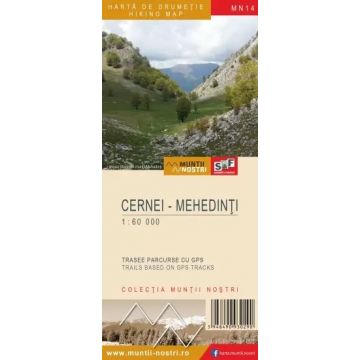
Wanderkarte MN-14, Cernei, Mehedinți 1:60.000
Banat
€ 9,90
inkl. MwSt.
derzeit nicht auf Lager
Lieferung in 7 bis 14 Werktagen
Tags
The Cernei and Mehedinti Mountains are an important part of the Southern Carpathians, situated within the Retezat - Godeanu Mountain Group, the highest peaks being Dobri Peak (1,928 m) in the Cerna Mountains and Varful lui Stan Peak (1,466 m) in the Mehedinti Mountains. This mountain chain has a total length of 50 kilometers, the rectilinear ridges of the Cerna and Mehedinti Mountains being oriented in southwest-northeast direction, with a width of up to 10 kilometers. These massifs have 500 to 800 meter steep slopes down to Cerna Valley, the boundary between the Cerna and the Mehedinti Mountains. The western boundary of these mountains is linear, consisting of Cerna Valley from the point where it flows into the Danube to the confluence with Bela Reca, continues with Bela Reca to the confluence with Mehadica Creek up to Poarta Orientala Pass. To the north, they border the Valcan Mountains and the Godeanu Mountains, where the limit of the Cerna and Mehedinti Mountains is represented by Paraul Rece, Olanului Valley and the source of Motru River. The eastern boundary of the Cerna and Mehedinti Mountains towards Mehedinti Plateau is represented by a series of small depressions: Closani, Obarsia Closani, Isverna, Podeni; and continues with Bahna Creek up to the point where it flows into the Danube. The southern boundary is the Danube.
Cernei-Mehedinți Mountains hiking map MN 14 is dedicated to the Cernei-Mehedinti Mountains, one of the most spectacular mountain regions in the Southern Carpathians.
If you want to go looking for unforgettable hiking in Romania, Schubert & Franzke has created the hiking map, indispensable for such a journey.
The map of Cernei - Mehedinti Mountains (MN14) is the 14th map of the new Muntii Nostri collection.
The map was edited using the latest mapping techniques and it was printed on moisture resistant paper. It is easy to read and simple to use due to the mapping styles, specific to Schubert & Franzke company, and as a result of practical information structuring. It is handy and everything is exactly where it should be. The map is useful for both hiking enthusiasts and professionals.
The Baile Herculane area was digitized at a more detailed scale: 1 : 25 000.
All the trails have been recorded in the field using a GPS. They are described in detail in both Romanian and English, some trails having representative images attached to them. Each trail has a technical box containing: trail marking checked in the field, trail route, profile with major landmarks, data on difficulty, length, total ascent, total descent, round-trip time, practicability depending on the season and so on. The map also contains the UTM grid, a projected coordinate metric system useful in the quick measurement of distances on the map. Shading and contour lines highlight the landscape and facilitate orientation.
Gewicht:
68 g
Reihe:
Maßstab:
1:60.000
Medienart:
Karten
Sprache:
Englisch, Rumänisch
EAN:
5948490930634
Erscheinungsjahr:
2022
Schreibe deine eigene Bewertung
Hersteller
Name:
Adresse:
E-Mail-Adresse:
Telefonnummer:
Verantwortlich für die EU
Name:
Adresse:
E-Mail-Adresse:
Telefonnummer:
Gefahrenhinweis:
Produktart: