Wanderkarte MN-07, Făgăraș 1:35:000/1:75.000
Südkarpaten
€ 16,50
inkl. MwSt.
derzeit nicht auf Lager
Lieferung in 7 bis 14 Werktagen
Tags
Kartenset aus 2 Einzelkarten
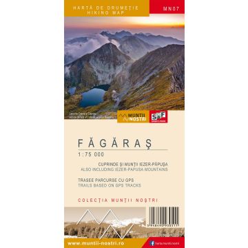
The Fagaras Mountains are a mountain range in the Southern Carpathians with the highest peak in Romania, Moldoveanu Peak 2,544 meters. From east to west, the Fagaras are 70 km long and from north to south, about 45 km long. The mountains look like a huge east-to-west oriented spine, with the "ribs" (ridges) oriented north to south. The northern ridges are much shorter and steeper than the southern ones, which are very long and gentle. The Fagaras Mountains are bordered in the west by the Olt Valley, and in the east by Barsa Grosetului and Dambovita rivers. In the north, they are bordered by the steep tectonic basin of the Fagaras Depression, also known as the Olt Land. To the north, the difference in elevation on a distance of only 8-10 km is of over 2,000 meters. To the south, the 30-40 km long ridges (Olanului, Robita, Scarisoara, Nisipuri, Zarna, etc.) create a much less pronounced boundary with the depressions (Campulung, Bradetu, Arefu and Jiblea). Across the Fagaras, there are 8 peaks with an elevation of over 2,500 meters: Moldoveanu 2,544 m, Negoiu 2,535 m, Vistea Mare 2,527 m, Caltun-Lespezi 2,522 m, Vanatoarea lui Buteanu 2,507 m, Cornu Caltunului 2,510 m, Hartopu 2,506 m, Dara 2,501 m. The highest alpine road in Romania, the Transfagarasan, crosses the Fagaras from north to south. There are few nature reserves in the Fagaras when compared to the great number of endemic plants and spectacular landscapes. The map of Fagaras Mountains (MN07) is the 7th map of the new Muntii Nostri collection. The map was edited using the latest mapping techniques and it was printed on moisture resistant paper. It is easy to read and simple to use due to the mapping styles, specific to Schubert & Franzke company, and as a result of practical information structuring. It is handy and everything is exactly where it should be. The map is useful for both hiking enthusiasts and professionals. All the trails have been recorded in the field using a GPS. They are described in detail in both Romanian and English. Each trail has a technical box containing with necessary information. The map also contains the UTM grid, a projected coordinate metric system useful in the quick measurement of distances on the map.
The Fagaras Mountains are a mountain range in the Southern Carpathians with the highest peak in Romania, Moldoveanu Peak 2,544 meters. From east to west, the Fagaras are 70 km long and from north to south, about 45 km long. The mountains look like a huge east-to-west oriented spine, with the "ribs" (ridges) oriented north to south. The northern ridges are much shorter and steeper than the southern ones, which are very long and gentle. The Fagaras Mountains are bordered in the west by the Olt Valley, and in the east by Barsa Grosetului and Dambovita rivers. In the north, they are bordered by the steep tectonic basin of the Fagaras Depression, also known as the Olt Land. To the north, the difference in elevation on a distance of only 8-10 km is of over 2,000 meters. To the south, the 30-40 km long ridges (Olanului, Robita, Scarisoara, Nisipuri, Zarna, etc.) create a much less pronounced boundary with the depressions (Campulung, Bradetu, Arefu and Jiblea). Across the Fagaras, there are 8 peaks with an elevation of over 2,500 meters: Moldoveanu 2,544 m, Negoiu 2,535 m, Vistea Mare 2,527 m, Caltun-Lespezi 2,522 m, Vanatoarea lui Buteanu 2,507 m, Cornu Caltunului 2,510 m, Hartopu 2,506 m, Dara 2,501 m. The highest alpine road in Romania, the Transfagarasan, crosses the Fagaras from north to south. There are few nature reserves in the Fagaras when compared to the great number of endemic plants and spectacular landscapes. The map of Fagaras Mountains (MN07) is the 7th map of the new Muntii Nostri collection. The map was edited using the latest mapping techniques and it was printed on moisture resistant paper. It is easy to read and simple to use due to the mapping styles, specific to Schubert & Franzke company, and as a result of practical information structuring. It is handy and everything is exactly where it should be. The map is useful for both hiking enthusiasts and professionals. All the trails have been recorded in the field using a GPS. They are described in detail in both Romanian and English. Each trail has a technical box containing with necessary information. The map also contains the UTM grid, a projected coordinate metric system useful in the quick measurement of distances on the map.
Gewicht:
185 g
Reihe:
Maßstab:
1:35:000
Medienart:
Karten
Sprache:
Englisch, Rumänisch
EAN:
5948490930665
Erscheinungsjahr:
2023
Schreibe deine eigene Bewertung
Hersteller
Name:
Adresse:
E-Mail-Adresse:
Telefonnummer:
Verantwortlich für die EU
Name:
Adresse:
E-Mail-Adresse:
Telefonnummer:
Gefahrenhinweis:
Produktart: