The store will not work correctly when cookies are disabled.
JavaScript scheint in Ihrem Browser deaktiviert zu sein. Um unsere Website in bester Weise zu erfahren, aktivieren Sie Javascript in Ihrem Browser.
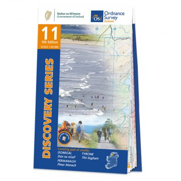
OSi Discovery Map 11, Donegal 1:50.000 OSi Discovery Map 11, Donegal 1:50.000
OSi Discovery Map 11, Donegal 1:50.000 € 17,90
inkl. MwSt.
lagernd
Lieferung in 2 bis 4 Werktagen
Mehr aus der Reihe: OSi Discovery Maps Bitte wählen Sie OSi Discovery Map 05, Ballycastle 1:50.000 OSi Discovery Map 1, Donegal 1:50.000 OSi Discovery Map 10, Donegal 1:50.000 OSi Discovery Map 20, Craigavon 1:50.000 OSi Discovery Map 23, Mayo/Maigh Eo 1:50.000 OSi Discovery Map 25, Sligo, Leitrim, Roscommon 1:50.000 OSi Discovery Map 27, Upper Lough Erne 1:50.000 OSi Discovery Map 30, Mayo 1:50.000 OSi Discovery Map 31, Mayo 1:50.000 OSi Discovery Map 32, Mayo, Sligo, Roscommon 1:50.000 OSi Discovery Map 33, Leitrim, Longford, Roscommon, Sligo 1:50.000 OSi Discovery Map 35, Cavan, Louth, Meath, Monaghan 1:50.000 OSi Discovery Map 36, Armagh, Down, Louth, Meath, Monaghan 1:50.000 OSi Discovery Map 37, Galway 1:50.000 OSi Discovery Map 38, Galway, Mayo 1:50.000 OSi Discovery Map 40, Galway, Roscommon, Longford, Westmeath 1:50.000 OSi Discovery Map 41, Longford, Westmeath, Meath 1:50.000 OSi Discovery Map 42, Westmeath, Meath 1:50.000 OSi Discovery Map 43, Dublin, Louth, Meath 1:50.000 OSi Discovery Map 48, Offaly, Westmeath 1:50.000 OSi Discovery Map 49, Kildare, Offaly, Meath, Westmeath 1:50.000 OSi Discovery Map 52, Clare/An Clar, Galway/Gaillimh 1:50.000 OSi Discovery Map 54, Laois, Offaly, Tipperary 1:50.000 OSi Discovery Map 55, Kildare, Laois, Offaly, Wicklow 1:50.000 OSi Discovery Map 57, Clare/An Clár 1:50.000 OSi Discovery Map 58, Clare, Limerick, Tipperary 1:50.000 OSi Discovery Map 59, Clare, Tipperary, Offaly 1:50.000 OSi Discovery Map 6, Donegal, Tyrone 1:50.000 OSi Discovery Map 60, Kilkenny, Laois, Tipperary 1:50.000 OSi Discovery Map 61, Carlow, Kildare, Kilkenny, Laois, Wicklow 1:50.000 OSi Discovery Map 61, Carlow, Kildare, Kilkenny, Laois, Wicklow 1:50.000 OSi Discovery Map 65, Clare, Limerick, Tipperary 1:50.000 OSi Discovery Map 67, Kilkenny, Tipperary 1:50.000 OSi Discovery Map 69, Wexford 1:50.000 OSi Discovery Map 72, Cork, Kerry, Limerick 1:50.000 OSi Discovery Map 73, Cork, Limerick 1:50.000 OSi Discovery Map 75, Kilkenny, Tipperary, Waterford 1:50.000 OSi Discovery Map 76, Carlow, Kilkenny, Waterford, Wexford 1:50.000 OSi Discovery Map 77, Wexford 1:50.000 OSi Discovery Map 78, Kerry 1:50.000 OSi Discovery Map 81, Cork/Corcaigh, Waterford/Port Láirge 1:50.000 OSi Discovery Map 82, Waterford 1:50.000 OSi Discovery Map 86, Cork 1:50.000 OSi Discovery Map 87, Cork/Corcaigh 1:50.000 OSi Discovery Map 88, Cork/Corcaigh 1:50.000 Tags Map Hiking Wandern Atlantik Wanderkarte Outdoor Éire ireland Irische Atlantikküste Atlantic Ocean Ordnance Survey OS-i
Schreibe deine eigene Bewertung Hersteller Name:
Adresse:
E-Mail-Adresse:
Telefonnummer:
Verantwortlich für die EU Name:
Adresse:
E-Mail-Adresse:
Telefonnummer:
Noch keine Herstellerangaben und Sicherheitshinweise verfügbar.
Folge uns
4,9 basierend auf 1514 Bewertungen
Zahlungsarten
Kundenbewertungen
Falls Sie Wiederverkäufer sind bestellen Sie bitte direkt über unsere Auslieferung damit wir ihre Konditionen berücksichtigen können:Österreich + Deutschland +43-1-869 90 90-800 sales.at@freytagberndt.com
Bei Bestellung über unseren Webshop kommen ausschließlich Endkundenpreise zur Anwendung und eine nachträgliche Korrektur ist leider nicht möglich.
Ihr Team von freytag & berndt