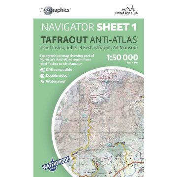
OAC Navigator Sheet 1, Tafraout 1:50.000
Anti-Atlas
€ 24,90
inkl. MwSt.
derzeit nicht auf Lager
Lieferung in 6 bis 10 Wochen
Tags
Jebel Taskra, Jebel el Kest, Tafraout, Ait Mansour
Waterproof 1:50.000 scale topographical map
for climbers, trekkers and tourists
Printed on ultra-tough, waterproof, tearproof PolyArt paper, this 1:50.000 scale map is perfect for exploring the Tafraout region by car, bike, or on foot.
This is a double-sided sheet, covering the Anti-Atlas region around Tafraout, including the popular climbing areas of Jebel Taskra and Jebel el Kest, as well as Tafraout, the Painted Rocks, Adrar Mqorn and the Ait Mansour Gorge. For full coverage details, please see the product images.
Fullt updated for 2025, this is the clearest mapping ever created for this incredible region and will be a superb resource for anyone looking to climb or walk in the mountains around Tafraout.
Gewicht:
67 g
Verlag:
Maßstab:
1:50.000
Medienart:
Karten
Sprache:
Englisch
EAN:
9781913167196
Erscheinungsjahr:
2025
Kontinent: Afrika
Land: Marokko
Region: Antiatlas
Orte / Berge / Seen: Tafraoute, Jbel el-Kest, Tal der Ammeln, Aït Mansour, Djebel Taskra, Adrar Mqorn
Schreibe deine eigene Bewertung
Hersteller
Name:
Adresse:
E-Mail-Adresse:
Telefonnummer:
Verantwortlich für die EU
Name:
Adresse:
E-Mail-Adresse:
Telefonnummer:
Gefahrenhinweis:
Produktart:
