The store will not work correctly when cookies are disabled.
JavaScript scheint in Ihrem Browser deaktiviert zu sein. Um unsere Website in bester Weise zu erfahren, aktivieren Sie Javascript in Ihrem Browser.
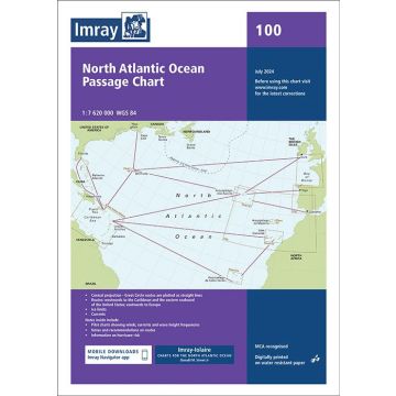
Imray Seekarte - 100 North Atlantic Ocean Passage Chart 1:7.620.000 Imray Seekarte - 100 North Atlantic Ocean Passage Chart 1:7.620.000
Passage Chart, 1:7.620.000
Imray Seekarte - 100 North Atlantic Ocean Passage Chart 1:7.620.000 Passage Chart, 1:7.620.000
€ 36,90
inkl. MwSt.
lagernd
Lieferung in 2 bis 4 Werktagen
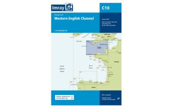
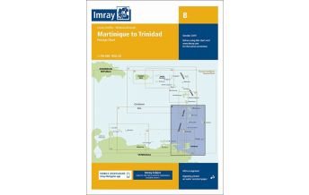
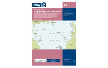
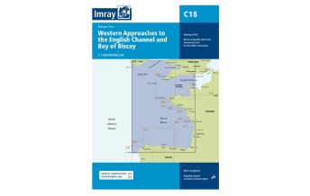
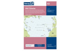
Mehr aus der Reihe: Imray Seekarten Imray Charts Bitte wählen Sie Imray Chart M9, South Sardegna (Sardinien) 1:255.000 Imray Chart Y30 - Isle of Wight 1:100.000 (Laminated) Imray Seekarte A2 - Puerto Rico to St Christopher 1:400.000 Imray Seekarte A2 - Puerto Rico to St Christopher 1:400.000 Imray Seekarte - 100 North Atlantic Ocean Passage Chart 1:7.620.000 Imray Seekarte - A131 Isla de Culebra and Isla de Vieques 1:33,500 / 1:44,500 Imray Seekarte - A26 Barbuda 1:45.000 Imray Seekarte - A281 Anchorages in Guadeloupe, Les Saintes and Marie-Galante 1:20.000 / 1:75.000 Imray Seekarte - A29 Dominica 1:75.000 Imray Seekarte - B4 Tobago 1:65.000 Imray Seekarte - C35 Baie de Morlaix to L'Aberlldut 1:75,000 Imray Seekarte - D22 Isla los Roques and Isla de Aves 1:89.700 / 1:164.950 Imray Seekarte - G40 Kas to Antalya 1:200.000 Imray Seekarte A1 - Puerto Rico 1:285.000 Imray Seekarte A23 - Virgin Islands and St Croix 1:285.000 Imray Seekarte A24 - Anguilla, St Martin and St Barthelemy 1:100.000 Imray Seekarte A25 – St Eustatius, St Christopher, Nevis, Monserrat and Saba 1:30.000/1:100.000 Imray Seekarte A27 - Antigua 1:50.000 Imray Seekarte A271 - North Coast of Antigua 1:35.000 Imray Seekarte A28 - Guadeloupe 1:150.000 Imray Seekarte A30 - Martinique 1:95.000 Imray Seekarte A301 - Martinique- South and East Coasts 1:60.000 Imray Seekarte Adria - M23 Adriatic Sea 1:750.000 Imray Seekarte Adria - M30 Southern Adriatic and Ionian Seas 1:850.000 Imray Seekarte B - Martinique to Trinidad Passage Chart 1:750.000 Imray Seekarte B2 - Barbados 1:60.000 Imray Seekarte B3 - The Grenadines - St Vincent to Grenada 1:200.000 Imray Seekarte B30 - The Grenadines North Sheet - St. Vincent to Mustique 1:90.000 Imray Seekarte B31 - The Grenadines Middle Sheet - Bequia to Carriacou 1:90.000 Imray Seekarte B311 - Middle Grenadines 1:32.500 Imray Seekarte B32 - Carriacou to Grenada 1:90.000 Imray Seekarte B5 - Martinique to Tobago and Barbados Passage Chart 1:500.000 Imray Seekarte B6 - Grenada to Tobago and Trinidad 1:375.000 Imray Seekarte C1 - Thames Estuary 1:120.000 Imray Seekarte C10 - Western English Channel Passage Chart 1:400.000 Imray Seekarte C12 - Eastern English Channel Passage Chart 1:300.000 Imray Seekarte C12 - Eastern English Channel Passage Chart 1:300.000 Imray Seekarte C14 - Plymouth Harbour and Rivers 1:20.000 Imray Seekarte C19 - A Coruna to Gibraltar 1:825.000 Imray Seekarte C24 - Flamborough Head to Fife Ness 1:250.000 Imray Seekarte C25 - Harwich to River Humber and Holland 1:340.000 Imray Seekarte C25 - Harwich to River Humber and Holland 1:340.000 Imray Seekarte C28 - Harwich to Wells-next-the-Sea 1:125.000 Imray Seekarte C31 - Dover Strait to Le Havre 1:200.000 Imray Seekarte C33A - Channel Islands (North) 1:120.000 Imray Seekarte C33B, Channel Islands (South) 1:120.000 Imray Seekarte C33B, Channel Islands (South) 1:120.000 Imray Seekarte C34 - Cap d'Erquy to Ile de Batz 1:110.000 Imray Seekarte C38 - Anse de Benodet to Presqu'Ile de Quiberon 1.80.000 Imray Seekarte C39 - Lorient to Le Croisic 1:80.000 Imray Seekarte C4 - Needles Channel to Bill of Portland 1:75.000 Imray Seekarte C5 - Bill of Portland to Salcombe Harbour 1:100.000 Imray Seekarte C50 - Sines to Gibraltar 1:350.000 Imray Seekarte C51 - Cardigan Bay 1:145.000 Imray Seekarte C52 - Cardigan Bay to Liverpool 1:145.000 Imray Seekarte C53 - Donegal Bay to Rathlin Island 1:200.000 Imray Seekarte C55 - Dingle Bay to Galway Bay 1:200.000 Imray Seekarte C56 - Cork Harbour to Dingle Bay 1:170.000 Imray Seekarte C57 - Tuskar Rock to Old Head of Kinsale 1:170.000 Imray Seekarte C59 - Bristol Channel 1:115.000 Imray Seekarte C6 - Salcombe to Lizard Point 1:100.000 Imray Seekarte C60 - Gower Peninsula to Cardigan 1:130.000 Imray Seekarte C63 - Firth of Clyde 1:160.000 Imray Seekarte C64 - North Channel 1:160.000 Imray Seekarte C66 - Mallaig bis Rudha Reidh und Äußere Hebriden 1:155.000 Imray Seekarte C67 - North Minch and Isle of Lewis 1:155.000 Imray Seekarte C68 - Cape Wrath to Wick and Isle of Lewis 1:160.000 Imray Seekarte C69 - Loch Ryan to Belfast Lough and Strangford Lough 1:90.000 Imray Seekarte C7 - Falmouth to Isles of Scilly and Trevose Head 1:120.000 Imray Seekarte C70, Southern North Sea Passage Chart 1:900.000 Imray Seekarte C9 - Beachy Head to Isle of Wight 1:110.000 Imray Seekarte D1 - Port of Spain to Cabo Codera 1:583.700 Imray Seekarte D10 - North Coast of Trinidad and Golfo de Paria 1:145.000 / 1:234.000 Imray Seekarte D12 - Carupano to Cumana and Isla de Margarita 1:173.000 Imray Seekarte D13 - Isla de Margarita to Carenero - Tortuga 1:255.000 Imray Seekarte D131 - Puerto Mochima to Bahia de Barcelona 1:63.900 Imray Seekarte D14 - Islas los Testigos, Isla la Tortuga, la Blanquilla 1:30.000 / 1:60.000 Imray Seekarte D2 - Cabo Codera to Cabo San Roman 1:583.700 Imray Seekarte D23 - Punta Aguide to Cabo San Roman and the A, B, C Islands 1.255.400� Imray Seekarte D231 - Bonaire and Aruba 1:75.000 Imray Seekarte E3 - Arquipelago da Madeira 1:170.000 Imray Seekarte E4 - Arquipelago de Cabo Verde 1:500.000 Imray Seekarte E5 - Bermuda 1:60.000 Imray Seekarte Frankreich - M6 Île de Corse 1:255.000 Imray Seekarte Frankreich M15 - Marseille to San Remo 1:325.000 Imray Seekarte Frankreich M15 - Marseille to San Remo 1:325.000 Imray Seekarte G121 - The Inland Sea 1:95.000 Imray Seekarte G121, The Inland Sea 1:95.000 Imray Seekarte G14, Saronic and Argolic Gulfs 1:190.000 Imray Seekarte G141 - Saronikos Kolpos 1:110.000 Imray Seekarte G15, Southern Peloponnisos 1:190.000 Imray Seekarte G15, Southern Peloponnisos 1:190.000 Imray Seekarte G16, Western Peloponnisos 1:190.000 Imray Seekarte G2 - Aegean Sea (North) 1:750.000 Imray Seekarte G23 - Marmara Denizi 1:275.000 Imray Seekarte G25 - Northern Sporades and North Evvoia 1:190.000 Imray Seekarte G26 - Nisos Evvoia/Euböa 1:190.000 Imray Seekarte G27 - Nísos Lésvos & the Coast of Turkey 1:190.000 Imray Seekarte G28 - Nisos Khios & the Coast of Turkey 1:190.000 Imray Seekarte G3, Aegean Sea (South) 1:750.000 Imray Seekarte G31 - Northern Cyclades 1:200.000 Imray Seekarte G32 - Eastern Sporades, Dodecanese & the Coast of Turkey 1:200.000 Imray Seekarte G34 - Southern Cyclades (East Sheet) Imray Seekarte G38, Nísos Kríti East/Ostkreta 1:190.000 Imray Seekarte G39 - Nisos Karpathos to Nisos Rhodos 1:190.000 Imray Seekarte Griechenland - G13 Gulfs of Patras and Corinth 1:220.000 Imray Seekarte Griechenland - G13 Gulfs of Patras and Corinth 1:220.000 Imray Seekarte Griechenland - G21 Northwest Aegean Sea 1:275.000 Imray Seekarte Griechenland - G33 Southern Cyclades/Südliche Kykladen (West Sheet) 1:190.000 Imray Seekarte Griechenland - G35 Dodecanese and the Coast of Turkey 1:190.000 Imray Seekarte Griechenland - G35 Dodecanese and the Coast of Turkey 1:190.000 Imray Seekarte Griechenland - G37 Nisos Kriti (West) / Kreta West 1:190.000 Imray Seekarte Griechenland G1, Mainland Greece and the Peloponnisos 1:729.000 Imray Seekarte Griechenland G12, South Ionian Islands 1:190.000 Imray Seekarte Griechenland/Türkei G22, Northeast Aegean Sea 1:275.000 Imray Seekarte Italien - M34 Golfo di Venezia 1:220.000 Imray Seekarte Italien M31 - Sicily1:400.000 Imray Seekarte Italien M47 - Aeolian Islands / Sizilien 1:140.000 Imray Seekarte Italien M50 - Sardegna to Ionian Sea 1:1.000.000 Imray Seekarte Italien/Frankreich M40 - Ligurian and Tyrrhenian Seas 1:950.000 Imray Seekarte Kroatien - M26 Split to Dubrovnik 1:220.000 Imray Seekarte Kroatien - M27 Dubrovnik to Bar & Ulcinj 1:220.000 Imray Seekarte Kroatien M25 - Rab to Šibenik 1:220.000 Imray Seekarte M10 - Western Mediterranean 1:2.750.000 Imray Seekarte M14 - Barcelona to Bouches du Rhône 1:440.000 Imray Seekarte M17 - North Tuscan Islands to Rome 1:325 000 Imray Seekarte M18 - Capo d'Anzio to Capo Palinuro 1:325.000 Imray Seekarte M19 - Capo Palinuro to Punta Stilo 1:325.000 Imray Seekarte M21 - South Coast of Turkey, Syria, Lebanon and Cyprus 1:785.000 Imray Seekarte M22 - Egypt to Israel, Lebanon and Cyprus 1:785.000 Imray Seekarte M24 - Golfo di Trieste to Lošinj and Rab 1:220.000 Imray Seekarte M24 - Golfo di Trieste to Lošinj and Rab 1:220.000 Imray Seekarte M29 - Golf von Tarent 1:375 000 Imray Seekarte M3, Islas Baleares/Balearen 1:350.000 Imray Seekarte M32 - Adriatic Italy (South) 1:325.000 Imray Seekarte M33 - Adriatic Italy (North) 1:350.000 Imray Seekarte M35 - Sicilian Channel 1:375.000 Imray Seekarte M36 - South Coast of Sicilia to Malta 1:100.000 Imray Seekarte M45, Tuscan Archipelago - Elba 1:180.000 Imray Seekarte M46 - Isole Pontine to the Bay of Naples 1:180.000 Imray Seekarte M49 - West Sicily & the Egadi Islands Imray Seekarte M7 - Bonifacio Strait 1:65.000 Imray Seekarte Spanien - M13 Dénia to Barcelona and Ibiza 1:440.000 Imray Seekarte Spanien C43 - Santander to A Coruna 1:350.000 Imray Seekarte Spanien E2 - Islas Canarias / Kanarische Inseln 1:600.000 Imray Seekarte Spanien E2 - Islas Canarias / Kanarische Inseln 1:600.000 Imray Seekarte Y18 - The River Medway and Approaches 1:20.000 Imray Seekarte Y30, Isle of Wight 1:100.000 Imray Seekarte – C54 Galway Bay to Donegal Bay 1:200.000 Imray Seekarte – C54 Galway Bay to Donegal Bay 1:200.000 Imray Seekarte – C58 Trevose Head to Bull Point Imray Seekarte – Y70 Isle of Man 1:85.000 Imray Seekarte – A14 San Juan to Isla de Vieques and Isla Culebra 1:116.700 Imray Seekarte – C4 Needles Chanel to Bill of Portland Map of the Inland Waterways of France 1:1.500.000 Tags Seekarte Segeln nautical Chart Chart Nautical Nautic Approach Mooring
Schreibe deine eigene Bewertung Hersteller Name: FB Imray Laurie Norie & Wilson GmbH
Adresse: Ölzeltgasse 3/10, 1030 Wien, Österreich
Telefonnummer:
Verantwortlich für die EU Name:
Adresse:
E-Mail-Adresse:
Telefonnummer:
Noch keine Herstellerangaben und Sicherheitshinweise verfügbar.
Folge uns
4,9 basierend auf 1515 Bewertungen
Zahlungsarten
Kundenbewertungen
Falls Sie Wiederverkäufer sind bestellen Sie bitte direkt über unsere Auslieferung damit wir ihre Konditionen berücksichtigen können:Österreich + Deutschland +43-1-869 90 90-800 sales.at@freytagberndt.com
Bei Bestellung über unseren Webshop kommen ausschließlich Endkundenpreise zur Anwendung und eine nachträgliche Korrektur ist leider nicht möglich.
Ihr Team von freytag & berndt