The store will not work correctly when cookies are disabled.
JavaScript scheint in Ihrem Browser deaktiviert zu sein. Um unsere Website in bester Weise zu erfahren, aktivieren Sie Javascript in Ihrem Browser.
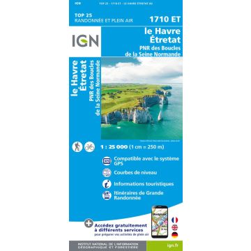
IGN Carte 1710 ET, Le Havre 1:25.000 IGN Carte 1710 ET, Le Havre 1:25.000
IGN Carte 1710 ET, Le Havre 1:25.000 € 16,90
inkl. MwSt.
derzeit nicht auf Lager
Lieferung in 7 bis 14 Werktagen
Mehr aus der Reihe: IGN Top 25 Bitte wählen Sie Angers Autun MontBeuvray 1:25.000 Beaujeu Bellevill 1:25.000 Beaujeu Bellevill 1:25.000 IGN Carte 0317 ET, Île d'Ouessant, Le Conquet 1:25.000 IGN Carte 0416 ET, Plouguerneau, Les Abers 1:25.000 IGN Carte 0417 ET, Brest 1:25.000 IGN Carte 0418 ET, Presqu’île de Crozon 1:25.000 IGN Carte 0419 ET, Audierne 1:25.000 IGN Carte 0515 ET, Saint-Pol-de-Leon, Roscoff 1:25.000 IGN Carte 0517 OT, Plougastel-Daoulas 1:25.000 IGN Carte 0518 OT, Châteaulin, Douarnenez 1:25.000 IGN Carte 0519 ET, Quimper 1:25.000 IGN Carte 0519 OT, Pont-L'Abbé 1:25.000 IGN Carte 0615 ET, Morlaix, Plestin-les-Grèves, Carantec 1:25.000 IGN Carte 0616 OT, Morlaix 1:25.000 IGN Carte 0620 ET, Quimperlé 1:25.000 IGN Carte 0714 OT, Lannion, Perros-Guirec 1:25.000 IGN Carte 0720 ET, Lorient, Ile de Groix 1:25.000 IGN Carte 0814 OT, Paimpol 1:25.000 IGN Carte 1116 ET, Saint-Malo 1:25.000 IGN Carte 1210 OT, Cherbourg-en-Cotentin 1:25.000 IGN Carte 1211 OT, Les Pieux 1:25.000 IGN Carte 1212 ET, La Haye-du-Puits 1:25.000 IGN Carte 1215 ET, Avranches, Granvilles 1:25.000 IGN Carte 1215 OT, Le Mont-Saint-Michel 1:25.000 IGN Carte 1245 OT, Hendaye, Saint-Jean-de-Luz 1:25.000 IGN Carte 1310 OT, Cherbourg-en-Cotentin 1:25.000 IGN Carte 1310 OT, Cherbourg-en-Cotentin 1:25.000 IGN Carte 1329 ET, La Rochelle 1:25.000 IGN Carte 1329 OT, Île de Ré 1:25.000 IGN Carte 1332 ET, Royan 1:25.000 IGN Carte 1339 ET, Biscarrosse 1:25.000 IGN Carte 1340 ET, Mimizan 1:25.000 IGN Carte 1341 ET, Castets 1:25.000 IGN Carte 1346 ET, Forêt d'Iraty, Pic d'Orhy 1:25.000 IGN Carte 1412 OT, Pointe du Hoc, Omaha Beach 1:25.000 IGN Carte 1430 OT, Rochefort 1:25.000 IGN Carte 1446 ET, Tardets-Sorholus, Arette 1:25.000 IGN Carte 1546 ET, Laruns, Gourette 1:25.000 IGN Carte 1546 OT, Oloron-Sainte-Marie 1:25.000 IGN Carte 1547 OT, Ossau, Valleé d'Aspe 1:25.000 IGN Carte 1612 ET, Caen 1:25.000 IGN Carte 1647 ET, Lourdes 1:25.000 IGN Carte 1711 OT, Honfleur, Deauville 1:25.000 IGN Carte 1727 SB, Poitiers, Coulombiers 1:25.000 IGN Carte 1747 ET, Bagnerès-de-Bigorre, Pic du Midi de Bigorre 1:25.000 IGN Carte 1748 ET, Néouvielle 1:25.000 IGN Carte 1748 OT, Gavarnie 1:25.000 IGN Carte 1809 OT, Fécamp 1:25.000 IGN Carte 1847 OT, Saint-Bertrand-de-Comminges 1:25.000 IGN Carte 1848 OT, Bagnères-de-Luchon 1:25.000 IGN Carte 1909 OT, Saint-Valery-en-Caux 1:25.000 IGN Carte 1922 SB, Amboise, Montlouis-sur-Loire 1:25.000 IGN Carte 2036 ET, Sarlat-la-Caneda, Souillac 1:25.000 IGN Carte 2047 ET, Massat 1:25.000 IGN Carte 2048 OT, Aulus-les-Bains 1:25.000 IGN Carte 2105 ET, Le Touquet-Paris-Plage, Berck 1:25.000 IGN Carte 2106 ET, Baie de Somme 1:25.000 IGN Carte 2107 OT, le Tréport 1:25.000 IGN Carte 2138 OT, Cahors 1:25.000 IGN Carte 2148 ET, Ax-les-Thermes 1:25.000 IGN Carte 2148 OT, Vicdessos 1:25.000 IGN Carte 2148 OT, Vicdessos 1:25.000 IGN Carte 2148 OT-R, Vicdessos 1:25.000 IGN Carte 2215 OT, Forêt de Rambouillet 1:25.000 IGN Carte 2215 OT-R, Forêt de Rambouillet 1:25.000 IGN Carte 2248 ET, Axat, Quérigut, Gorge de l'Aude 1:25.000 IGN Carte 2249 ET, Font-Romeu, Capcir 1:25.000 IGN Carte 2249 OT, Bourg-Madame 1:25.000 IGN Carte 2257 OT, Lavelanet, Montségur 1:25.000 IGN Carte 2314 OT, Paris 1:25.000 IGN Carte 2347 OT Frankreich - Quillan 1:25.000 IGN Carte 2348 ET, Prades 1:25.000 IGN Carte 2349 ET, Massif du Canigou 1:25.000 IGN Carte 2349 ET-R, Massif du Canigou 1:25.000 IGN Carte 2415 OT, Évry, Melun 1:25.000 IGN Carte 2417 OT, Forêt de Fontainebleau 1:25.000 IGN Carte 2425 SB, Dun sur Auron 1:25.000 IGN Carte 2433 SB, La Bourboule, Bourg Lastic 1:25.000 IGN Carte 2447 OT, Tuchan, Massif des Corbières 1:25.000 IGN Carte 2449 OT, Céret 1:25.000 IGN Carte 2537 OT, Nasbinals, Monts d'Aubrac 1:25.000 IGN Carte 2538 OT, Sainte-Eulalie-d'Olt 1:25.000 IGN Carte 2541 OT, Millau, Saint-Affrique 1:25.000 IGN Carte 2545 ET, Béziers 1:25.000 IGN Carte 2547 OT, Durban-Corbières, Leucate 1:25.000 IGN Carte 2548 OT, Perpignan/Perpinyà 1:25.000 IGN Carte 2549 OT, Banyuls 1:25.000 IGN Carte 2640 OT, Gorges du Tarn et de la Jonte 1:25.000 IGN Carte 2640 OT-R, Gorges du Tarn et de la Jonte 1:25.000 IGN Carte 2641 ET, Mont Aigoual 1:25.000 IGN Carte 2641 OT, Millau 1:25.000 IGN Carte 2645 ET, Sète, Cap d'Agde 1:25.000 IGN Carte 2731, Noirétable Martin 1:25.000
IGN Carte 2737 SB, Langogne, Grandrieu 1:25.000 IGN Carte 2738 SB, le Bleymard 1:25.000 IGN Carte 2739 OT, Mont Lozère, Florac 1:25.000 IGN Carte 2743 ET, Montpellier 1:25.000 IGN Carte 2822 OT, Quarre les Tombes 1:25.000 IGN Carte 2835 OT, Le Puy-en-Velay 1:25.000 IGN Carte 2839 OT, Bessèges, Les Vans 1:25.000 IGN Carte 2843 OT, Aigues-Mortes 1:25.000 IGN Carte 2935 OT, Le Chambon-sur-Lignon 1:25.000 IGN Carte 2939 OT, Gorges de l'Ardèche 1:25.000 IGN Carte 2941 OT, Uzès, Remoulins 1:25.000 IGN Carte 2942 OT, Nîmes, Beaucaire 1:25.000 IGN Carte 2943 ET, Arles, PNR de Camargue 1:25.000 IGN Carte 2944 OT, Saintes-Maries-de-la-Mer 1:25.000 IGN Carte 3036 OT, Valence 1:25.000 IGN Carte 3040 ET, Carpentras 1:25.000 IGN Carte 3040 OT, Orange 1:25.000 IGN Carte 3041 OT, Avignon 1:25.000 IGN Carte 3042 OT, Saint-Rémy-de-Provence 1:25.000 IGN Carte 3129 SB, Bourg-en-Bresse 1:25.000 IGN Carte 3136 ET, Combe Laval 1:25.000 IGN Carte 3137 OT, Die, Crest 1:25.000 IGN Carte 3139 OT, Nyons, Rémuzat 1:25.000 IGN Carte 3140 OT, Mont Ventoux 1:25.000 IGN Carte 3140 OT-R, Mont Ventoux 1:25.000 IGN Carte 3142 OT, Cavaillon, PNR du Luberon 1:25.000 IGN Carte 3143 ET, Aix-en-Provence 1:25.000 IGN Carte 3144 OT, Étang de Berre 1:25.000 IGN Carte 3145 ET, Marseille, Les Calanques 1:25.000 IGN Carte 3232 ET, Belley 1:25.000 IGN Carte 3233 SB, Voiron 1:25.000 IGN Carte 3235 OT, Autrans 1:25.000 IGN Carte 3236 OT, Villard-de-Lans 1:25.000 IGN Carte 3237 OT, Glandasse 1:25.000 IGN Carte 3239 OT, Rosans, Orpierre 1:25.000 IGN Carte 3242 OT, Apt, PNR du Luberon 1:25.000 IGN Carte 3244 ET, Montagne Sainte-Victoire 1:25.000 IGN Carte 3245 ET, Aubagne, la Ciotat 1:25.000 IGN Carte 3325 OT, Arbois 1:25.000 IGN Carte 3327 ET, Morez, les Rousses 1:25.000 IGN Carte 3331 OT, Rumilly, Seyssel 1:25.000 IGN Carte 3332 OT, Chambéry 1:25.000 IGN Carte 3333 OT, Massif de la Chartreuse Nord 1:25.000 IGN Carte 3334 OT, Massif de la Chartreuse Sud 1:25.000 IGN Carte 3335 ET, Le Bourg d'Oisans, L'Alpe d'Huez 1:25.000 IGN Carte 3335 OT, Grenoble 1:25.000 IGN Carte 3336 ET, les deux Alpes 1:25.000 IGN Carte 3336 OT, La Mure 1:25.000 IGN Carte 3337 OT, Dévoluy 1:25.000 IGN Carte 3338 ET, Gap, Montagne de Céüse 1:25.000 IGN Carte 3338 OT, Serres, Veynes, Haut Buëch 1:25.000 IGN Carte 3339 ET Frankreich - La Motte-du-Caire 1:25.000 IGN Carte 3339 OT, Sisteron 1:25.000 IGN Carte 3340 ET, Digne-les-Bains 1:25.000 IGN Carte 3342 OT, Manosque, Forcalquier 1:25.000 IGN Carte 3343 OT, Gréoux-les-bains, Rians 1:25.000 IGN Carte 3344 OT, Saint-Maximin-la-Sainte-Baume 1:25.000 IGN Carte 3345 OT, Signes, Tourves 1:25.000 IGN Carte 3426 OT, Mouthe, Métabief 1:25.000 IGN Carte 3428 ET, Thonon-les-Bains, Evian-les-Bains 1:25.000 IGN Carte 3429 ET, Bonneville 1:25.000 IGN Carte 3429 OT, Genève/Genf 1:25.000 IGN Carte 3430 ET, La Clusaz 1:25.000 IGN Carte 3430 OT, Mont Salève 1:25.000 IGN Carte 3431 OT, Lac d'Annecy 1:25.000 IGN Carte 3432 ET, Albertville 1:25.000 IGN Carte 3432 OT, Massif des Bauges 1:25.000 IGN Carte 3433 ET, Saint-Jean-de-Maurienne 1:25.000 IGN Carte 3433 OT, Allevard, Belledonne Nord 1:25.000 IGN Carte 3435 ET, Valloire 1:25.000 IGN Carte 3436 ET, Meije, Pelvoux 1:25.000 IGN Carte 3437 ET, Orcières-Merlette 1:25.000 IGN Carte 3437 ET-R Frankreich - Orcieres, Merlette 1:25.000 IGN Carte 3437 OT, Champsaur 1:25.000 IGN Carte 3438 ET, Embrun, les Orres 1:25.000 IGN Carte 3439 ET, Seyne 1:25.000 IGN Carte 3440 ET, Digne-les-Bains, La Javie, Vallée de la Bléone 1:25.000 IGN Carte 3441 OT, Barrême 1:25.000 IGN Carte 3442 OT, Gorges du Verdon 1:25.000 IGN Carte 3443 OT, Aups, Salernes 1:25.000 IGN Carte 3445 OT, Cuers 1:25.000 IGN Carte 3446 ET, Le Lavandou 1:25.000 IGN Carte 3446 OT, Hyères, Île de Porquerolles 1:25.000 IGN Carte 3518 OT, Épinal 1:25.000 IGN Carte 3519 OT, Remiremont 1:25.000 IGN Carte 3520 ET, Ballon d'Alsace/Elsässer Belchen 1:25.000 IGN Carte 3528 ET, Morzine 1:25.000 IGN Carte 3530 ET, Samoëns 1:25.000 IGN Carte 3531 ET, Saint-Gervais-les-Bains, Massif du Mont Blanc 1:25.000 IGN Carte 3531 ET-R, Saint-Gervais-les-Bains, Massif du Mont Blanc 1:25.000 IGN Carte 3531 OT, Megève, Col des Aravis 1:25.000 IGN Carte 3532 ET, Les Arcs, La Plagne 1:25.000 IGN Carte 3532 OT, Massif du Beaufortain 1:25.000 IGN Carte 3534 OT, Les Trois Vallées 1:25.000 IGN Carte 3535 OT, Névache, Mont Thabor 1:25.000 IGN Carte 3536 OT, Briançon, Serre Chevalier, Montgenèvre 1:25.000 IGN Carte 3537 ET, Guillestre 1:25.000 IGN Carte 3540 ET, Haute Vallée du Var 1:25.000 IGN Carte 3540 OT, Barcelonnette 1:25.000 IGN Carte 3541 OT, Annot 1:25.000 IGN Carte 3542 ET, Haut Estéron 1:25.000 IGN Carte 3542 OT, Castellane 1:25.000 IGN Carte 3543 ET, Haute Siagne 1:25.000 IGN Carte 3544 ET, Fréjus, Saint-Raphaël 1:25.000 IGN Carte 3544 OT, Le Muy, Lorgues 1:25.000 IGN Carte 3545 OT, Saint-Tropez, Sainte-Maxime 1:25.000 IGN Carte 3613 ET, Sarreguemines 1:25.000 IGN Carte 3616 OT, Lac de Pierre-Percée 1:25.000 IGN Carte 3617 OT, Saint-Dié-des-Vosges 1:25.000 IGN Carte 3618 OT, Gérardmer, Le Hohneck 1:25.000 IGN Carte 3619 OT, Bussang 1:25.000 IGN Carte 3620 ET, Grand Ballon/Großer Belchen 1:25.000 IGN Carte 3630 OT, Chamonix-Mont-Blanc 1:25.000 IGN Carte 3630 OT-R, Chamonix-Mont-Blanc 1:25.000 IGN Carte 3633 ET, Tignes, Val-d'Isère 1:25.000 IGN Carte 3634 OT, Val Cenis, Charbonnel 1:25.000 IGN Carte 3637 OT, Mont Viso 1:25.000 IGN Carte 3639 OT, Haute Tinée 1, 1:25.000 IGN Carte 3640 ET, Haute Tinée 2, 1:25.000 IGN Carte 3640 OT, Haut Cians 1:25.000 IGN Carte 3641 ET, Moyenne Tinée 1:25.000 IGN Carte 3641 OT, Moyen Var 1:25.000 IGN Carte 3642 ET, Vallée de l'Estéron 1:25.000 IGN Carte 3643 ET, Cannes, Grasse, Cote d'Azur 1:25.000 IGN Carte 3713 ET, Bitsch/Bitche 1:25.000 IGN Carte 3714 ET, la Petite-Pierre/Lützelstein 1:25.000 IGN Carte 3715 ET, Saverne, Wasselonne 1:25.000 IGN Carte 3715 OT, Sarrebourg, Phalsbourg 1:25.000 IGN Carte 3716 ET, le Donon, Obernai 1:25.000 IGN Carte 3717 ET, Barr 1:25.000 IGN Carte 3718 OT, Sélestat/Schlettstadt, Col du Bonhomme 1:25.000 IGN Carte 3719 OT, Colmar/Kolmar, Le Hohneck 1:25.000 IGN Carte 3720 ET, Mulhouse/Mülhausen 1:25.000 IGN Carte 3721 ET, Altkirch, Bâle/Basel 1:25.000 IGN Carte 3741 ET, Vallées de la Bévéra et des Paillons 1:25.000 IGN Carte 3741 OT, Vallée de la Vésubie 1:25.000 IGN Carte 3742 OT, Nice/Nizza, Menton 1:25.000 IGN Carte 3814 ET, Haguenau/Hagenau, Lembach 1:25.000 IGN Carte 3816 OT, Strasbourg/Straßburg 1:25.000 IGN Carte 3841 OT, Vallée de la Roya 1:25.000 IGN Carte 3914 OT, Wissembourg/Weißenburg 1:25.000 IGN Carte 4149 OT, Calvi, Cirque de Bonifatu 1:25.000 IGN Carte 4150 OT, Porto 1:25.000 IGN Carte 4151 OT, Vico, Cargèse 1:25.000 IGN Carte 4153 OT, Ajaccio 1:25.000 IGN Carte 4154 OT, Propriano 1:25.000 IGN Carte 4249 OT, L'Île-Rousse 1:25.000 IGN Carte 4250 OT, Corte, Monte Cinto 1:25.000 IGN Carte 4251 OT, Monte d'Oro, Monte Rotondo 1:25.000 IGN Carte 4252 OT, Monte Renoso, Bastelica 1:25.000 IGN Carte 4253 ET, Aiguilles de Bavella, Solenzara 1:25.000 IGN Carte 4253 OT, Petreto-Bicchisano, Zicavo 1:25.000 IGN Carte 4254 ET, Porto-Vecchio 1:25.000 IGN Carte 4255 OT, Bonifacio 1:25.000 IGN Carte 4347 OT, Cap Corse 1:25.000 IGN Carte 4348 OT, Bastia 1:25.000 IGN Carte 4349 OT, Vescovato 1:25.000 IGN Carte 4351 OT, Cervione 1:25.000 IGN Carte 4352 OT, Aléria, Ghisonaccia 1:25.000 IGN Carte 4401 RT, St-Paul, Le Port 1:25.000 IGN Carte 4402 RT, St-Denis 1:25.000 IGN Carte 4403 RT, St-Benoît, St-André 1:25.000 IGN Carte 4404 RT, St-Leu 1:25.000 IGN Carte 4405 RT, St-Pierre 1:25.000 IGN Carte 4406 RT, Piton de la Fournaise 1:25.000 IGN Carte 4410 MT, Mamoudzou, Mtsamboro 1:25.000 IGN Carte 4501 MT, Fort-de-France 1:25.000 IGN Carte 4502 MT, Le Lamentin 1:25.000 IGN Carte 4503 MT, Le Marin 1:25.000 IGN Carte 4604 GT, Saint-François 1:25.000 IGN Carte 4606 GT, Île Saint-Martin, Île Saint-Barthélemy 1:25.000 IGN Carte 4798 SB, Saint-Pierre et Miquelon 1:25.000 IGN Carte M1329 OT, Île de Ré 1:25.000 IGN Carte M2417 OT, Forêt de Fontainebleau 1:25.000 IGN WK 0916 ET Erquy, Le Val-Andre 1:25.000 Tags Map Hiking Wandern Wanderkarte France Outdoor nordfrankreich La Manche Carte topographique Randonnée et Plein Air the English Channel Série bleue 1710-ET normandy Seine-Mündung
Schreibe deine eigene Bewertung Hersteller Name:
Adresse:
E-Mail-Adresse:
Telefonnummer:
Verantwortlich für die EU Name:
Adresse:
E-Mail-Adresse:
Telefonnummer:
Noch keine Herstellerangaben und Sicherheitshinweise verfügbar.
Folge uns
4,9 basierend auf 1515 Bewertungen
Zahlungsarten
Kundenbewertungen
Falls Sie Wiederverkäufer sind bestellen Sie bitte direkt über unsere Auslieferung damit wir ihre Konditionen berücksichtigen können:Österreich + Deutschland +43-1-869 90 90-800 sales.at@freytagberndt.com
Bei Bestellung über unseren Webshop kommen ausschließlich Endkundenpreise zur Anwendung und eine nachträgliche Korrektur ist leider nicht möglich.
Ihr Team von freytag & berndt