The store will not work correctly when cookies are disabled.
JavaScript scheint in Ihrem Browser deaktiviert zu sein. Um unsere Website in bester Weise zu erfahren, aktivieren Sie Javascript in Ihrem Browser.
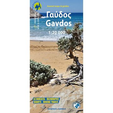
Anavasi Topo Island Map 11.20, Gávdos 1:20.000 Anavasi Topo Island Map 11.20, Gávdos 1:20.000
Anavasi Topo Island Map 11.20, Gávdos 1:20.000 € 8,90
inkl. MwSt.
lagernd
Lieferung in 4 bis 7 Werktagen
Mehr aus der Reihe: Anavasi Topo Islands Bitte wählen Sie Anavasi Topo Island Map 10.00, Aígina/Ägina 1:25.000 Anavasi Topo Island Map 10.11, Skiáthos 1:25.000 Anavasi Topo Island Map 10.20, Tínos 1:25.000 Anavasi Topo Island Map 10.21, Ándros 1:27.000 Anavasi Topo Island Map 10.23, Páros, Antíparos 1:40.000 Anavasi Topo Island Map 10.24, Santoríni, Thirasía 1:25.000 Anavasi Topo Island Map 10.26, Sífnos 1:25.000 Anavasi Topo Island Map 10.27, Amorgós 1:32.000 Anavasi Topo Island Map 10.28, Náxos 1:40.000 Anavasi Topo Island Map 10.29, Síkinos 1:25.000 Anavasi Topo Island Map 10.30, Lémnos 1:60.000 Anavasi Topo Island Map 10.33, Chálki 1:20.000 Anavasi Topo Island Map 10.34, Nísyros 1:15.000 Anavasi Topo Island Map 10.36, Lesser Cyclades/Kleine Kykladen 1:25.000 Anavasi Topo Island Map 10.38, Rhodes/Ródos/Rhodos 1:75.000 Anavasi Topo Island Map 10.39, Pátmos 1:20.000 Anavasi Topo Island Map 10.40, Hydra 1:25.000 Anavasi Topo Island Map 10.41, Kéa/Tziá 1:25.000 Anavasi Topo Island Map 10.42, Délos, Mýkonos, Rheneia/Rínia 1:25.000 Anavasi Topo Island Map 10.43, Spétses 1:12.500 Anavasi Topo Island Map 10.44, Kýthnos 1:31.000 Anavasi Topo Island Map 10.45, Mílos, Kímolos, Polýegos/Polyaigos 1:32.000 Anavasi Topo Island Map 10.46, Folégandros 1:18.000 Anavasi Topo Island Map 10.47, Anáfi 1:18.000 Anavasi Topo Island Map 10.49, Astypálaia 1:35.000 Anavasi Topo Island Map 10.50, Kárpathos, Saría 1:43.000 Anavasi Topo Island Map 10.51, Ikaria 1:35.000 Anavasi Topo Island Map 10.52, Sámos 1:70.000 Anavasi Topo Island Map 10.53, Lésvos / Lesbos 1:70.000 Anavasi Topo Island Map 7.1, Thásos/Thassos 1:36.000 Anavasi Topo Island Map 9.2, Alónnisos/Alonisos 1:30.000 Anavasi Topo Island Map 9.2, Paxós, Antípaxos 1:17.000 Anavasi Topo Island Map 9.3, Cephalonia/Kefaloniá, Ithaca/Itháki/Ithaka 1:65.000/1:25.000 Anavasi Topo Island Map 9.4, Corfu/Korfu 1:40.000 Anavasi Topo Islands 10.14, Skýros 1:40.000 Anavasi Topo Islands 10.22, Sýros 1:25.000 Anavasi Topo Islands 10.25, Sérifos 1:20.000 Tags Karte Map Mittelmeer Hiking Wandern topografisch Wanderkarte Outdoor greece Griechische Insel Inselkarte PolyArt Libysches Meer
Schreibe deine eigene Bewertung Hersteller Name:
Adresse:
E-Mail-Adresse:
Telefonnummer:
Verantwortlich für die EU Name:
Adresse:
E-Mail-Adresse:
Telefonnummer:
Noch keine Herstellerangaben und Sicherheitshinweise verfügbar.
Folge uns
4,9 basierend auf 1516 Bewertungen
Zahlungsarten
Kundenbewertungen
Falls Sie Wiederverkäufer sind bestellen Sie bitte direkt über unsere Auslieferung damit wir ihre Konditionen berücksichtigen können:Österreich + Deutschland +43-1-869 90 90-800 sales.at@freytagberndt.com
Bei Bestellung über unseren Webshop kommen ausschließlich Endkundenpreise zur Anwendung und eine nachträgliche Korrektur ist leider nicht möglich.
Ihr Team von freytag & berndt