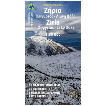
Anavasi Topo 30 Map 8.31, Zíria (Kyllíni) 1:30.000
Peloponnes

€ 10,90
inkl. MwSt.
lieferbar
Lieferung in 4 bis 7 Werktagen
Tags
Hiking Map of Μount Ziria in scale 1:30.000
Mount Ziria (probably from the Slavic word for "dawn") or Kilini or Cyllene as it was called in Ancient times, is the second highest mountain in the Peloponnese at 2374 m.
Despite its high altitude by Greek mountains standards, it has mild relief and fertile lands. Large plateaus and valleys compose the mountain scenery and below them lie the two large basins of Feneos and Stimfalia, with the homonymous lake.The new Anavasi map, in scale 1:30.000 is double-sided and covers the region around the mountain, starting from the famous mountainous village of Trikala and stretching south to Lafka and Psari by including the mountain of Oligirtos.The variety and beauty of the landscape is unique, maybe because of the harmonious coexistence of nature, myth and history.
Ziria 1:30.000 is above all a hiking map aiming to guide your steps towards nature through 30 interesting signposted routes with detailed information on the distances and duration.
Last but not least, the new edition contains 8 cycling routes.
Gewicht:
71 g
Verlag:
Reihe:
Maßstab:
1:30.000
Medienart:
Karten
Sprache:
Deutsch, Englisch, Französisch, Neugriechisch
EAN:
9789609412490
Erscheinungsjahr:
2023
Schreibe deine eigene Bewertung
Hersteller
Name:
Adresse:
E-Mail-Adresse:
Telefonnummer:
Verantwortlich für die EU
Name:
Adresse:
E-Mail-Adresse:
Telefonnummer:
Gefahrenhinweis:
Produktart:
