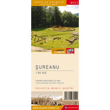
Wanderkarte MN-22, Șureanu 1:80.000
Südkarpaten

Tags
The Sureanu Mountains are a mountain group in the Southern Carpathians, bordered to the north by Orastie Corridor; to the east by the Cindrel Mountains via Sebes Valley; to the south by the Parang Mountains via Lotrului Valley and Jiet Valley, by Petrosani Depression (northeastern part) and by the Retezat Mountains via Baita Valley, Merisor Pass, Crivaia Valley and Strei Valley; to the west by Hateg Depression and Hunedoara Depression.
The geology of the Sureanu Mountains consists of crystalline schist in combination with limestone, microconglomerates and Jurassic sandstone on the western side. The highest peaks are Lui Patru Peak 2,130 m, Sureanu Peak 2,059 m, Batrana Peak 1,792 m.
The most important tourist attractions are the ruins of the Dacian fortresses (some of them are UNESCO heritage sites) such as Sarmizegetusa Regia, Costesti-Cetatuie, Costesti-Blidaru, Capalna, Piatra Rosie, Banita; the gorge sections typical of the karst landscape - Crivadia Gorge, Jgheabului Gorge, Banita Gorge; the natural and scientific reserves - Sureanu Lake Nature Reserve, the Scientific Reserve of Ponorici-Cioclovina Karst Complex, the Speleological Scientific Reserve of Sura Mare Cave, etc.
The map of Sureanu Mountains (MN22) is the 22nd map of the new Muntii Nostri collection.
The map was edited using the latest mapping techniques and it was printed on moisture resistant paper. It is easy to read and simple to use due to the mapping styles, specific to Schubert & Franzke company, and as a result of practical information structuring. It is handy and everything is exactly where it should be. The map is useful for both hiking enthusiasts and professionals.
The Gradistea Muntelui-Cioclovina and Sureanu Peak- Oasa Lake areas was digitized at a more detailed scale: 1 : 40 000.
All the trails have been recorded in the field using a GPS. They are described in detail in both Romanian and English, some trails having representative images attached to them. Each trail has a technical box containing: trail marking checked in the field, trail route, profile with major landmarks, data on difficulty, length, total ascent, total descent, round-trip time, practicability depending on the season and so on. The map also contains the UTM grid, a projected coordinate metric system useful in the quick measurement of distances on the map. Shading and contour lines highlight the landscape and facilitate orientation.
Reihe:
Maßstab:
1:80.000
Medienart:
Karten
Sprache:
Englisch, Rumänisch
EAN:
5948490930429
Erscheinungsjahr:
2019


