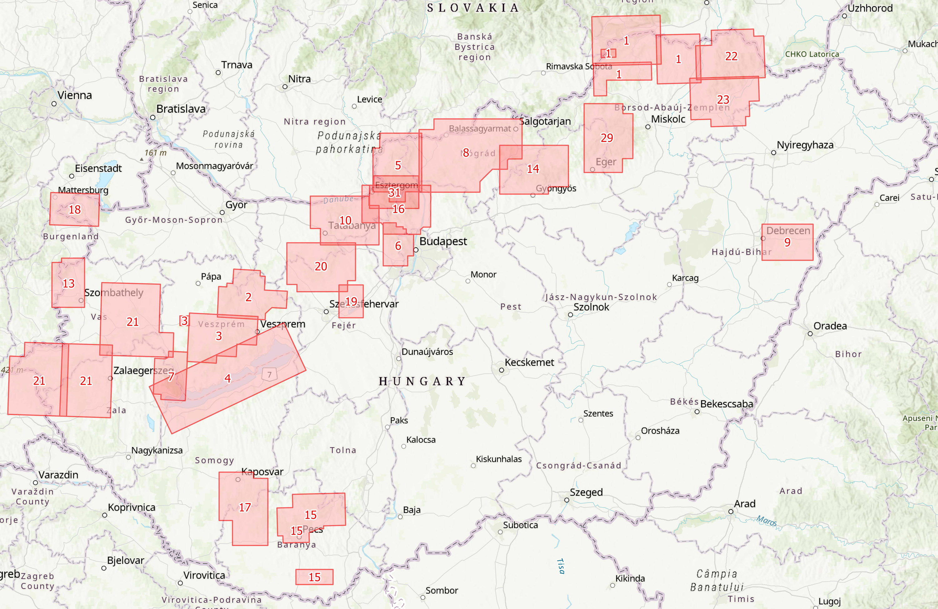
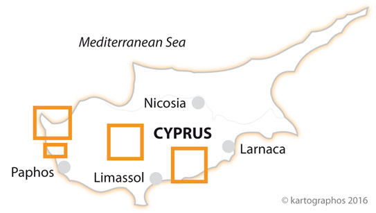
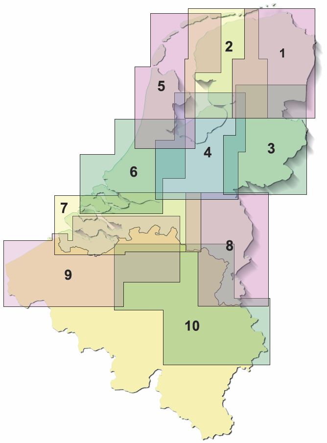
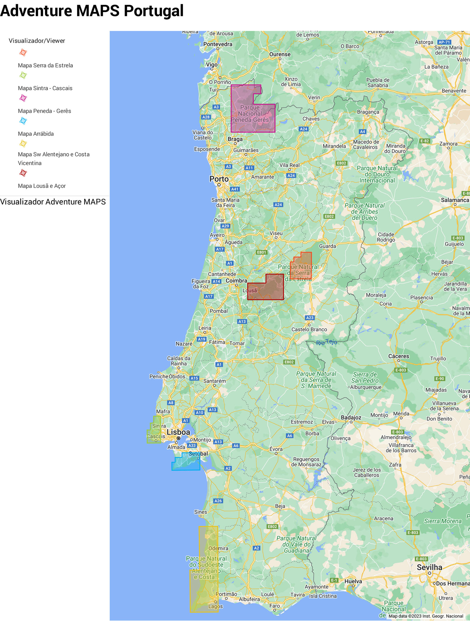
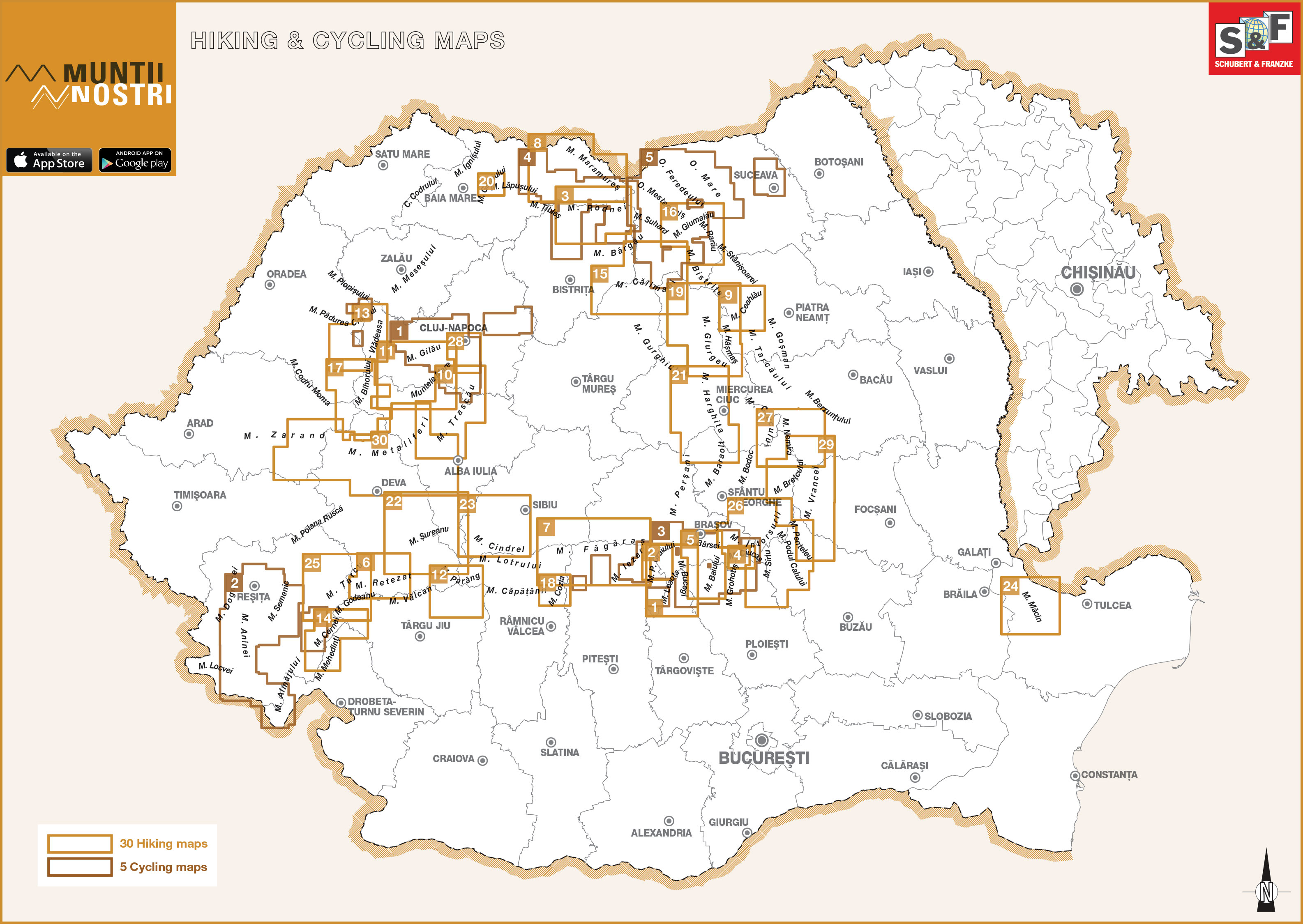
Hiking Maps Overviews and Sheet Divisions
With our Chart-Finder you can quickly and easily find the right map..
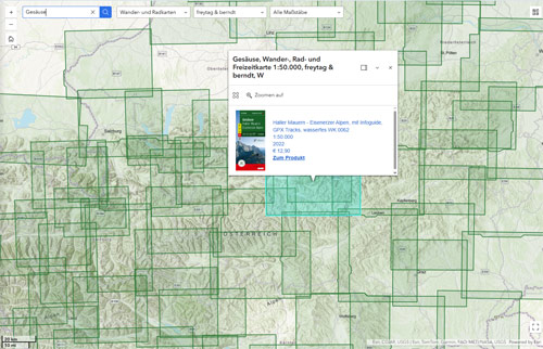
If your desired region or a specific publisher is not yet included in the chart finder, you may find it in this overview. Here, we have compiled the sheet indexes and coverage maps of the most important hiking map series by country.
For each country, the relevant map publishers are listed. The overviews show which maps cover which regions.
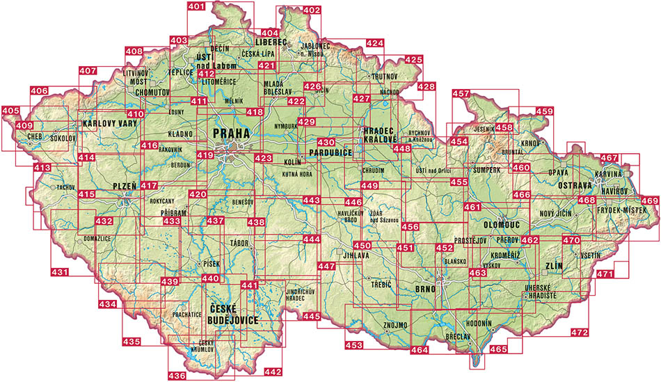
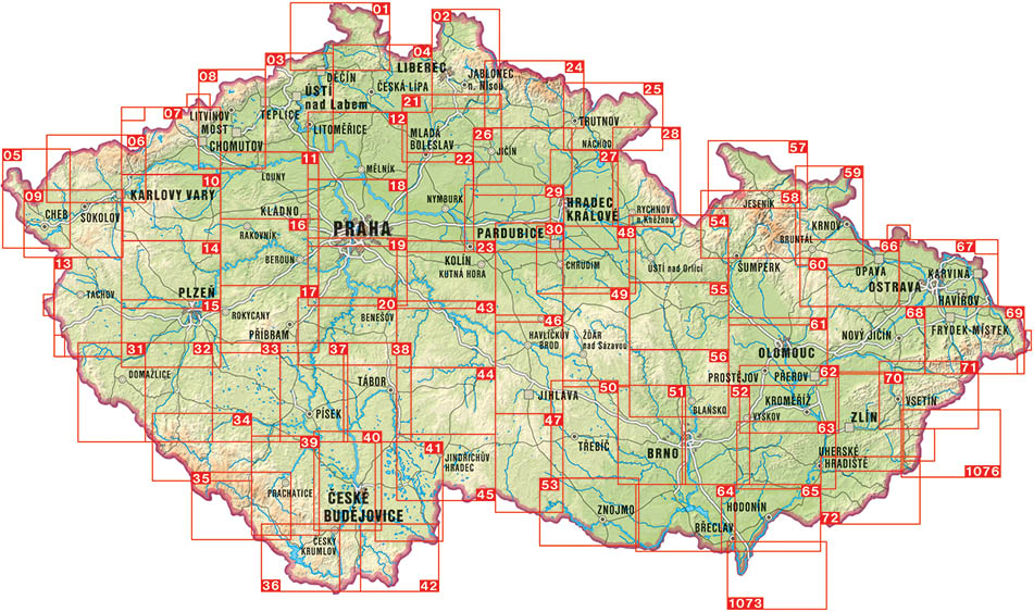
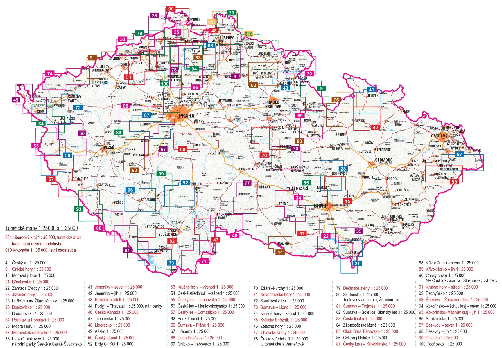
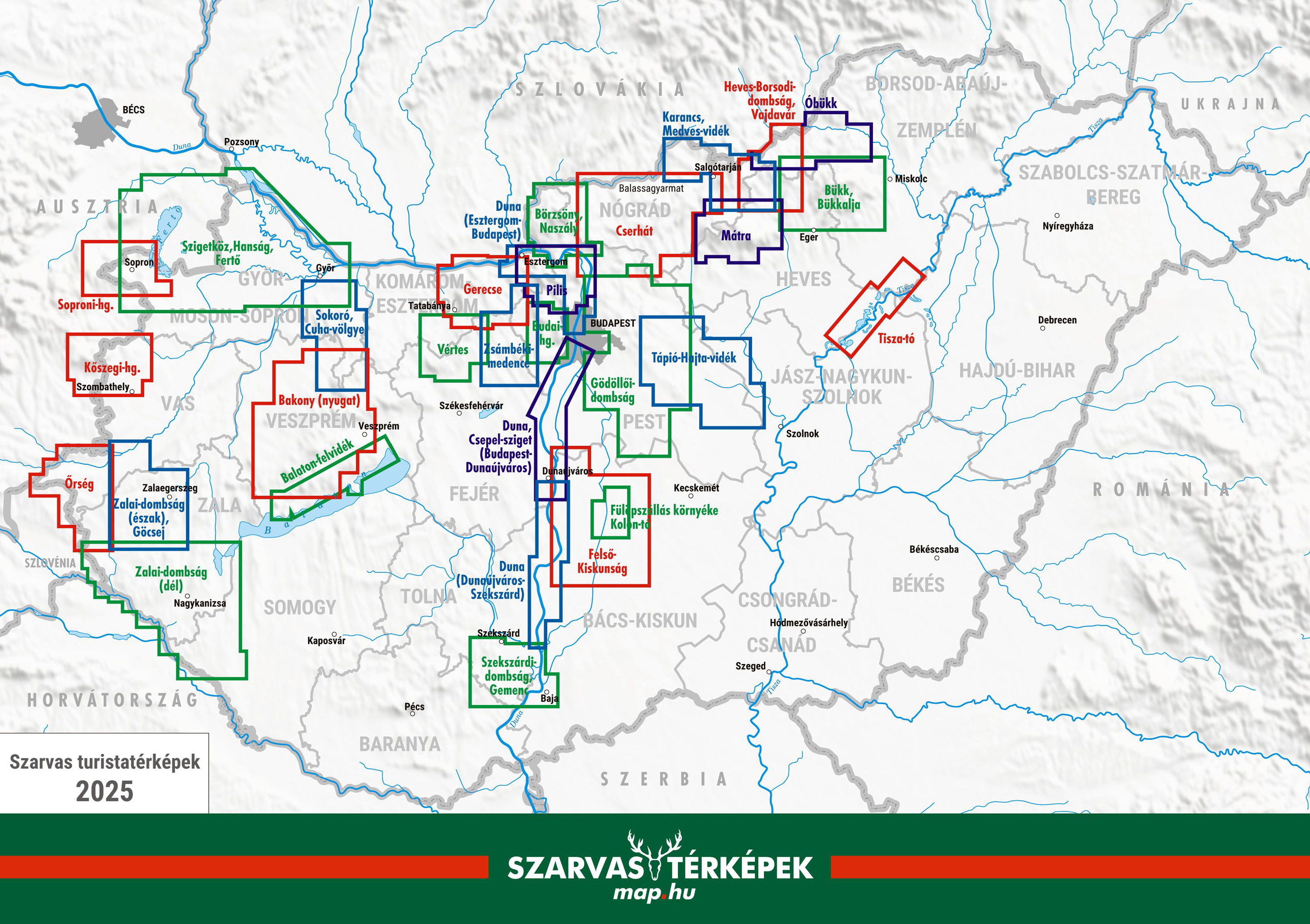
Depending on availability, the sheet indexes can be opened as an interactive map, image file, or PDF. Using the sheet numbers, you can then easily find the desired hiking map via the search function in our webshop.
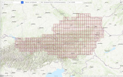
BEV – Bundesamt für Eich- und Vermessungswesen
BEV Bundesamtskarten ÖK25V-UTM
Go to Shop: Maßstab 1:25.000
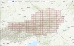
BEV – Bundesamt für Eich- und Vermessungswesen
BEV Bundesamtskarten ÖK50-UTM
Go to Shop: Maßstab 1:50.000
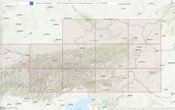
Bundesamt für Eich- und Vermessungswesen
BEV Bundesamtskarten ÖK250-UTM
Go to Shop: Maßstab 1:250.000

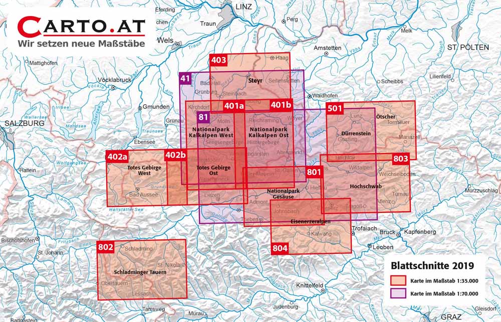
Carto.at
Niederösterreich, Oberösterreich, Steiermark
Go to Shop: Wander-, Rad- und Skitourenkarten 1:35.000
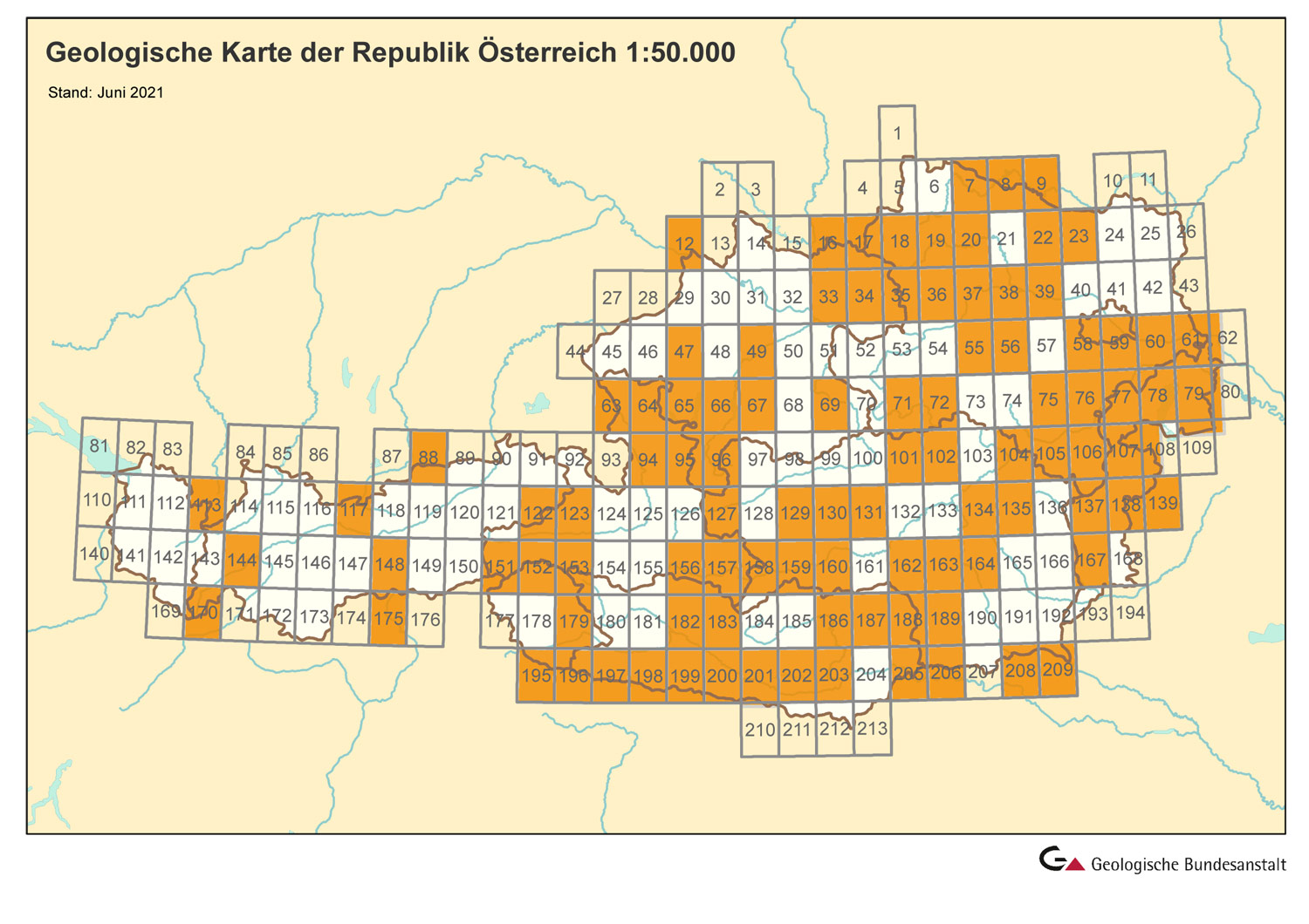
Geologische Bundesanstalt
Geologische Karte Österreich
Go to Shop: Maßstab 1:50.000
DAV und ÖAV – Alpenvereinskarten
Bayern, Österreich

Publicpress
Eine Marke von freytag & berndt
Publicpress
Eine Marke von freytag & berndt
Go to Shop: Publicpress Radkarten 1:50.000 – 1:100.000

ADFC - Allgemeiner Deutscher Fahrrad-Club
Mit den Niederlanden, Österreich, Friaul-Julisch Venetien, Südtirol, Trentino und Veneto
Go to Shop: Radkarten 1:150.000
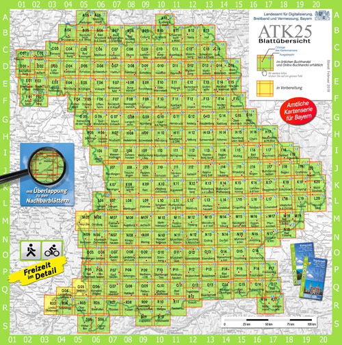
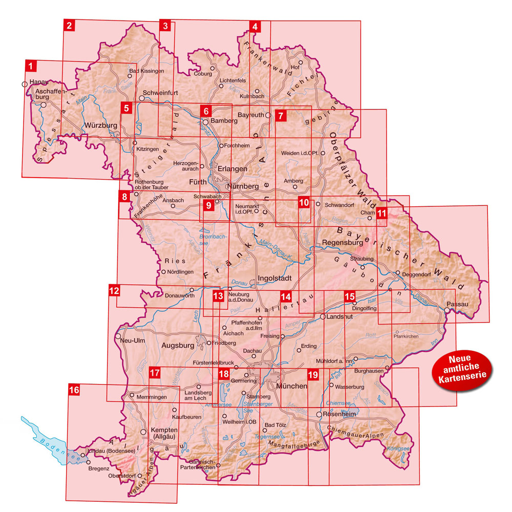
Bayerische ATK25
Landesamt für Digitalisierung, Breitband und Vermessung, Bayern
Go to Shop: Amtliche topografische Karten Bayern 1:25.000

Bayerische UK50
Landesamt für Digitalisierung, Breitband und Vermessung, Bayern
Go to Shop: Umgebungskarten Bayern 1:50.000
Bayerische ATK100
Landesamt für Digitalisierung, Breitband und Vermessung, Bayern
Go to Shop: Amtliche topografische Karten Bayern 1:100.000
Esterbauer Bikeline Radkarten
mit Österreich und Südtirol
Go to Shop: Bikeline Radkarten 1:75.000 – 1:100.000

Kompass Wanderkarten
mit Bornholm, Elsass und Luxemburg
Go to Shop: Wanderkarten 1:15.000 - 1:50.000
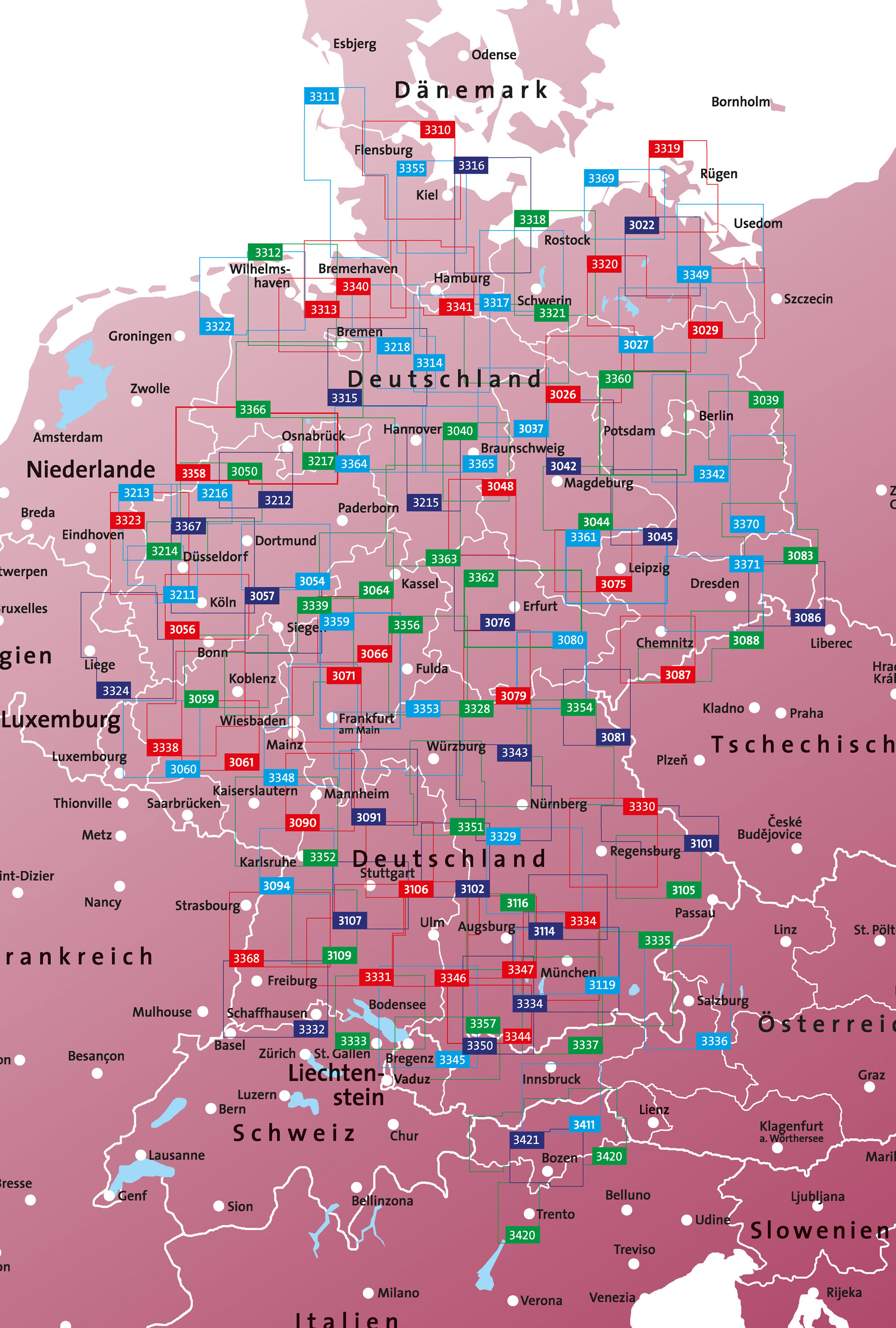
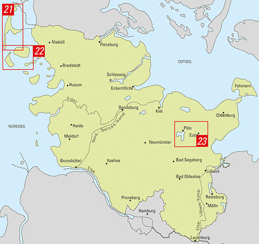
Landesamtskarten Schleswig-Holstein
Landesamt für Vermessung und Geoinformation
Go to Shop: Amtliche Wander- und Freizeitkarten 1:25.000
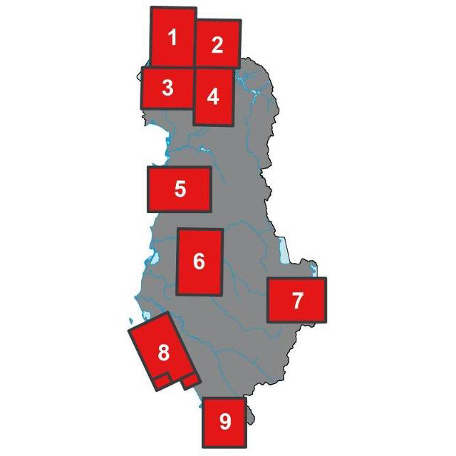


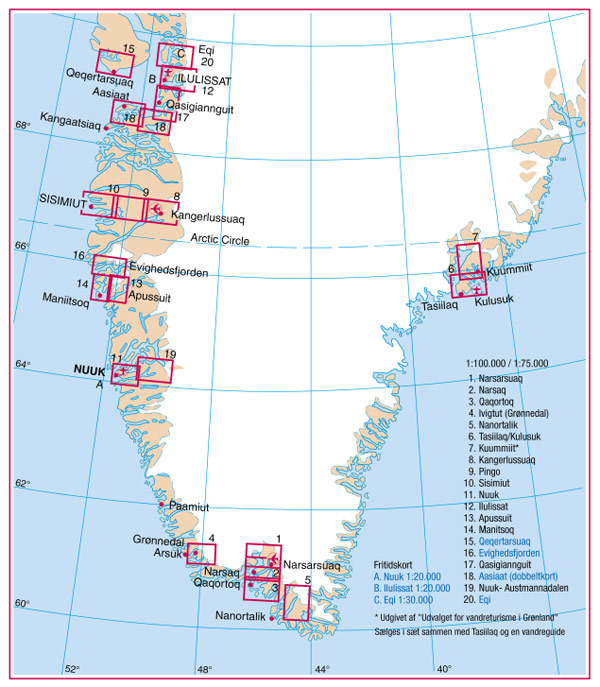
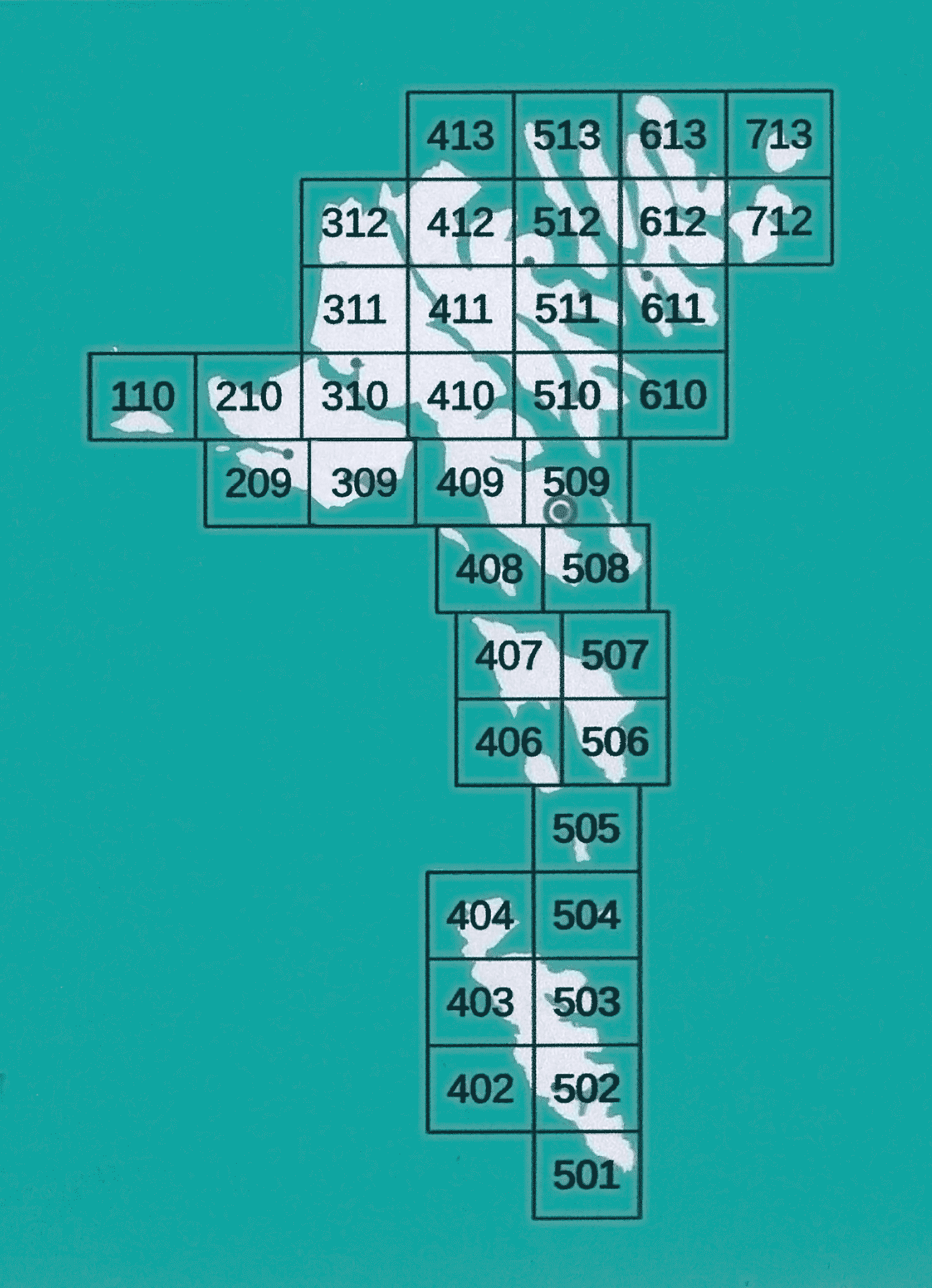
Udvalget for Vandreturisme i Grønland
Grönland
Go to Shop: Wanderkarten Grönland 1:30.000 - 1.100.000
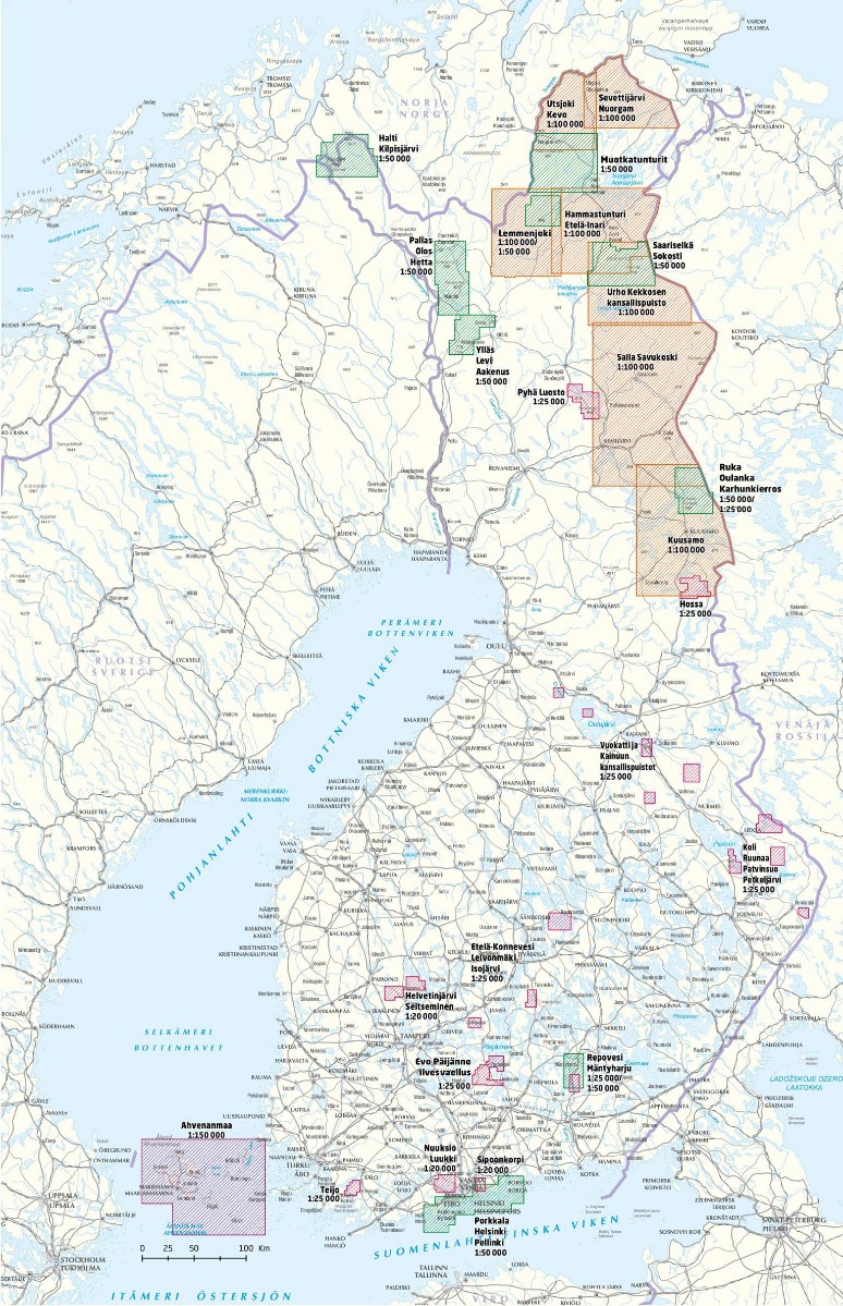
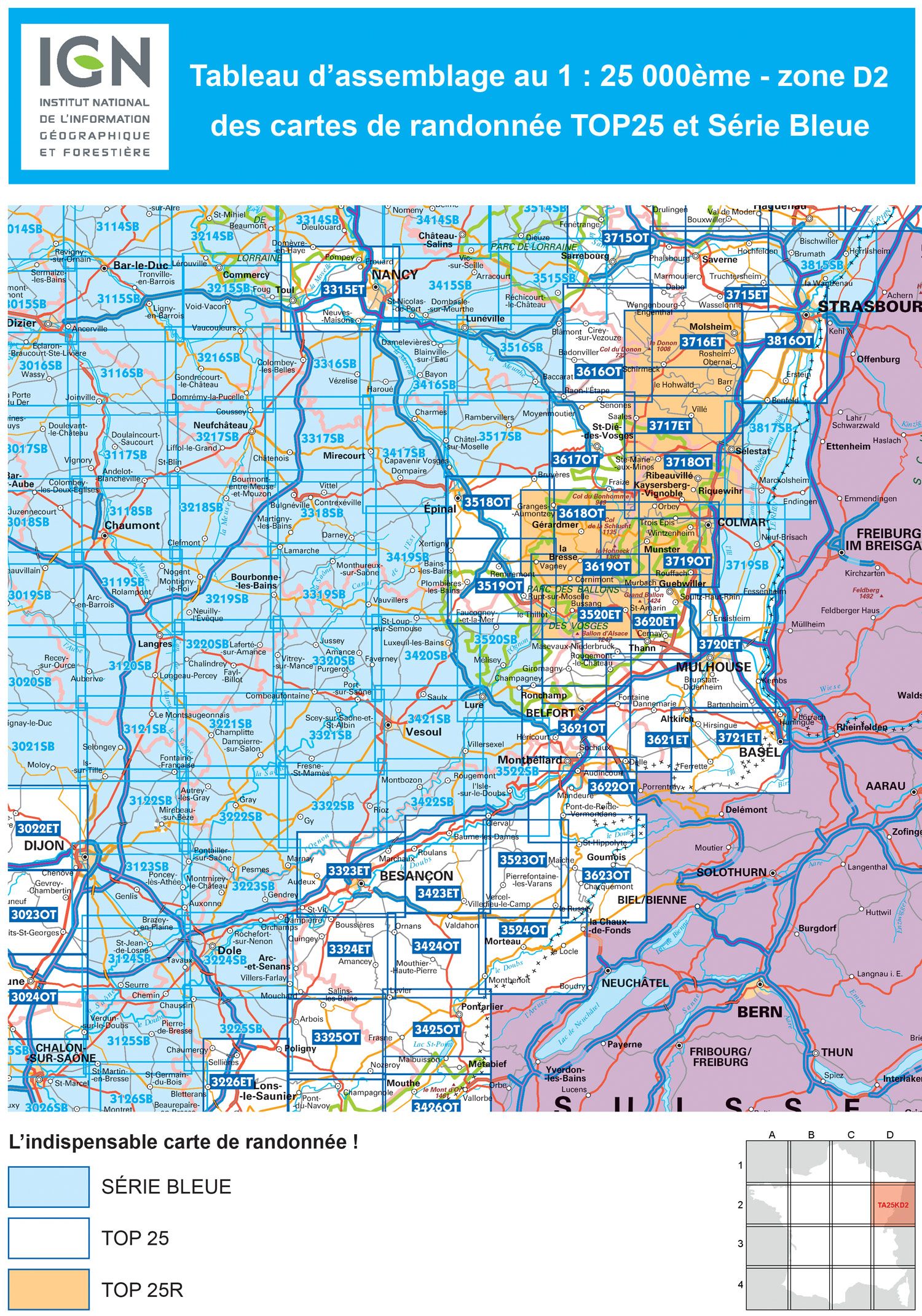
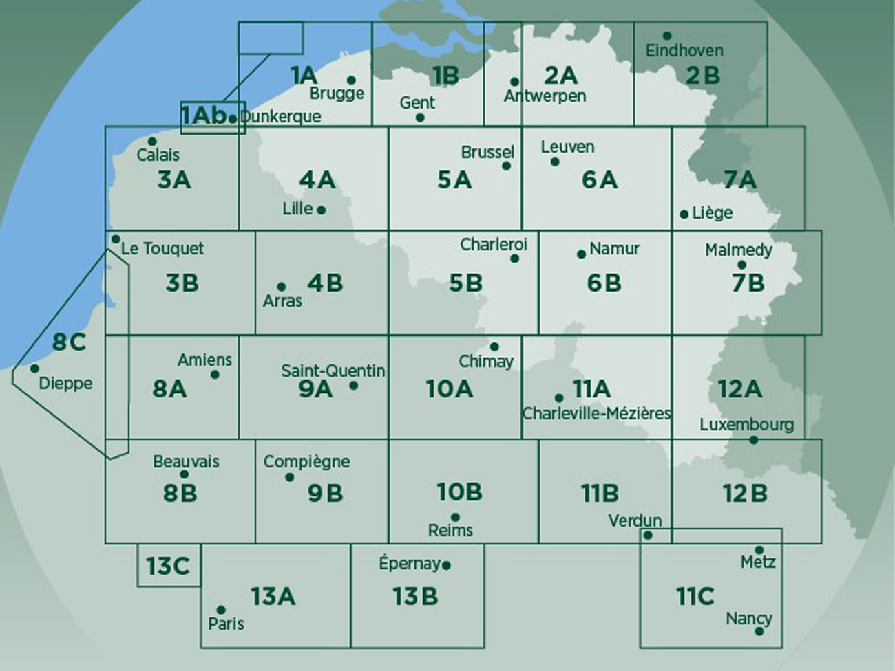
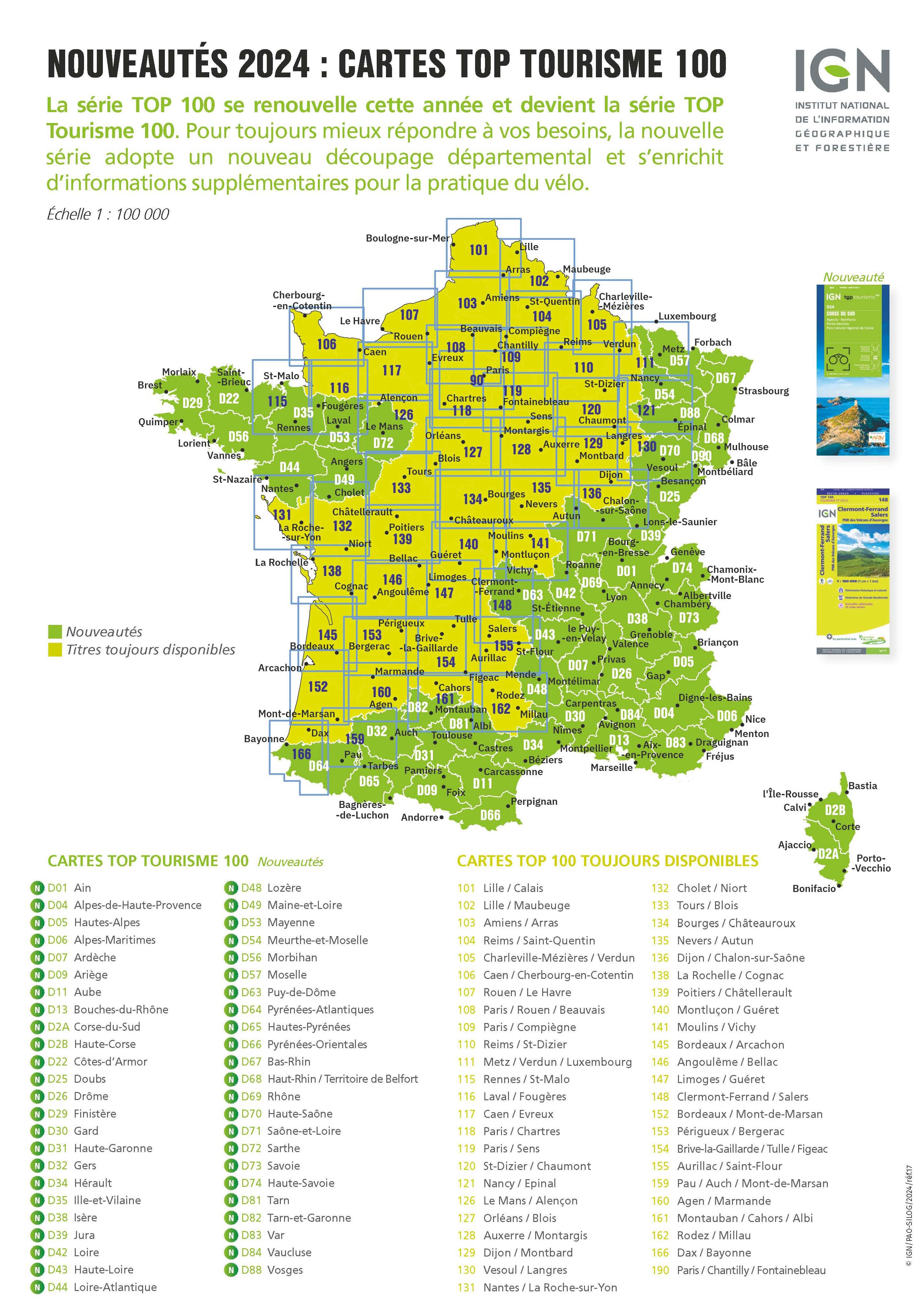
IGN - Institut national de l’information géographique et forestière
Elsass, Jura
Go to Shop: amtliche Wanderkarten 1:25.000
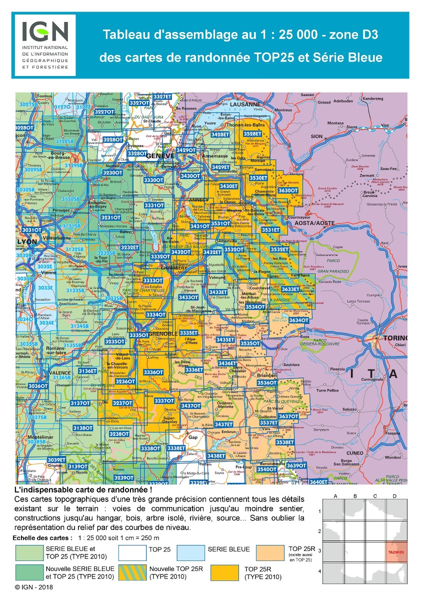
IGN - Institut national de l’information géographique et forestière
Französische Alpen – Nord
Go to Shop: amtliche Wanderkarten 1:25.000
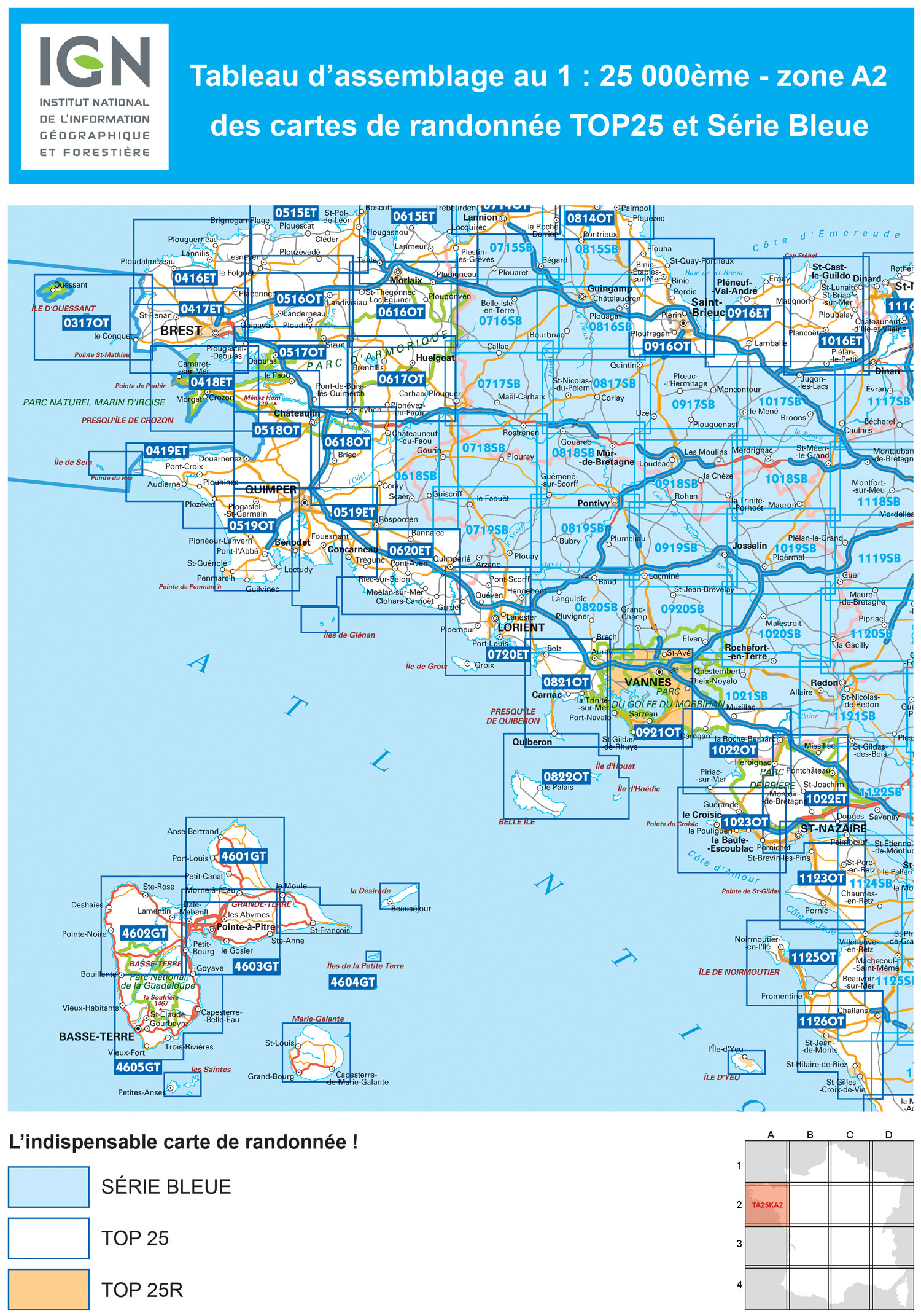
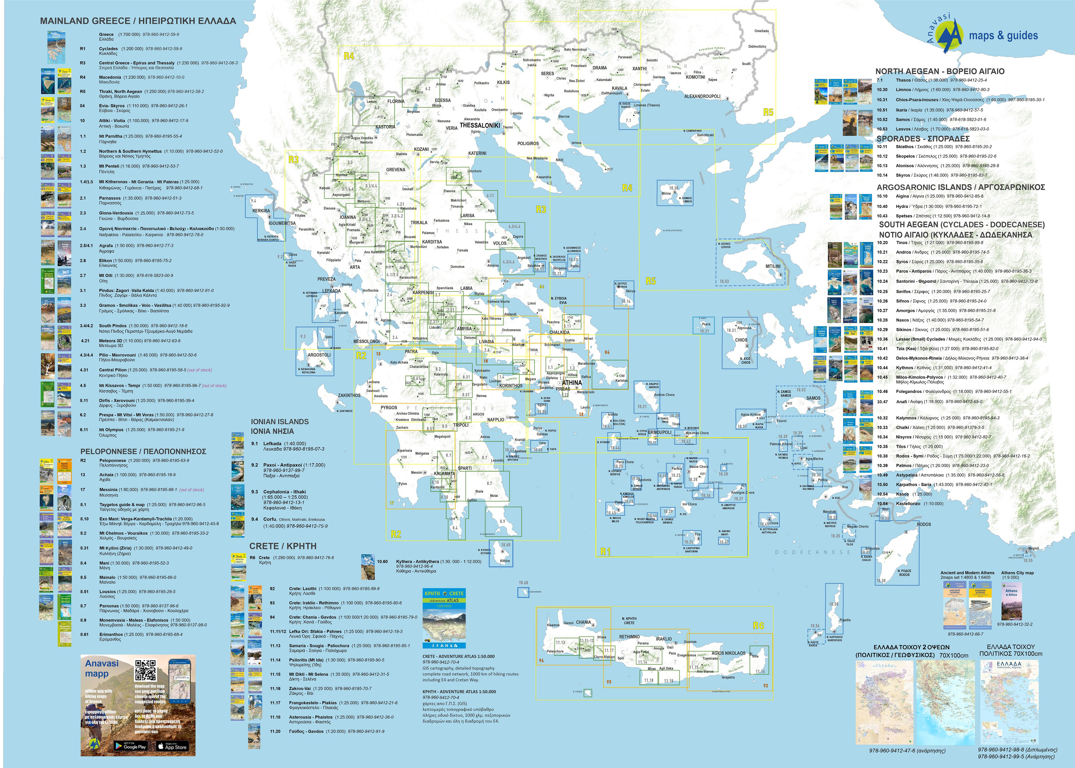
IGN - Institut national de l’information géographique et forestière
Bretagne, Guadeloupe
Go to Shop: amtliche Wanderkarten 1:25.000
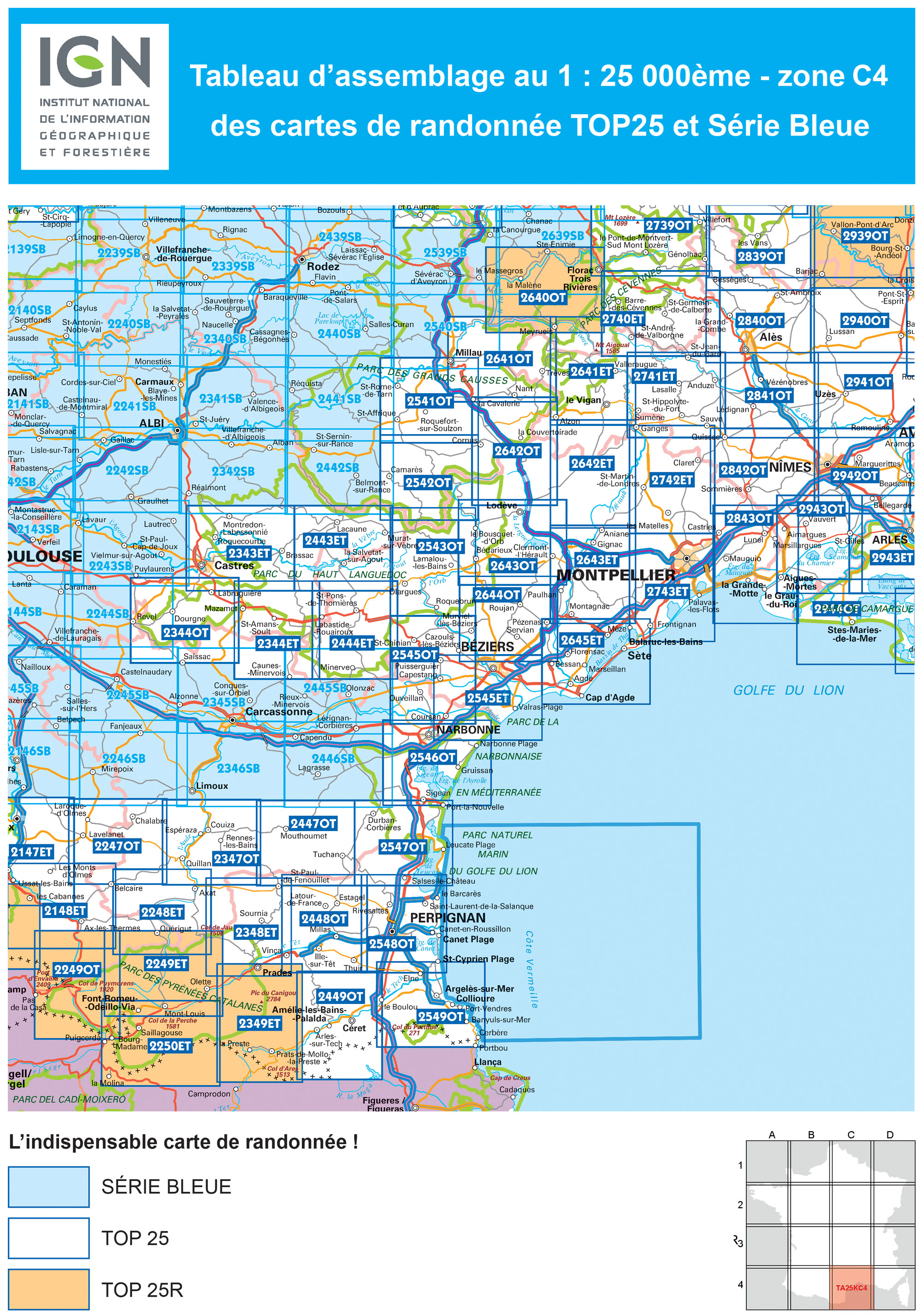
IGN - Institut national de l’information géographique et forestière
Cevennen, Languedoc, Roussillon
Go to Shop: amtliche Wanderkarten 1:25.000
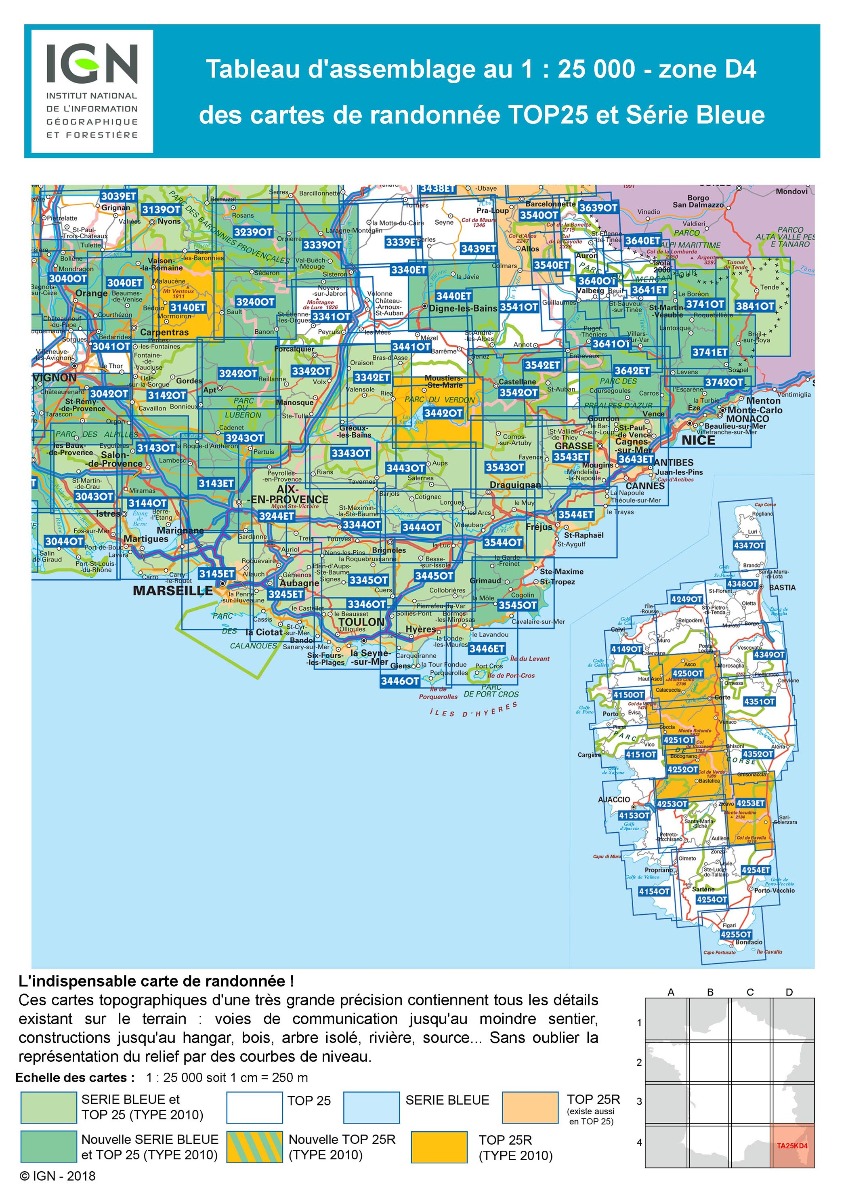
IGN - Institut national de l’information géographique et forestière
Korsika, Provence-Alpes-Côte d’Azur
Go to Shop: amtliche Wanderkarten 1:25.000
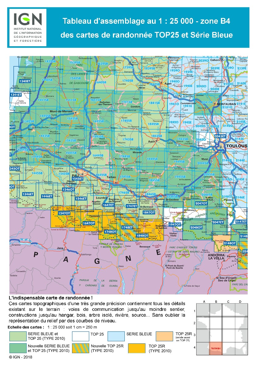
IGN - Institut national de l’information géographique et forestière
Südwestfrankreich
Go to Shop: amtliche Wanderkarten 1:25.000
IGN - Institut national de l’information géographique et forestière
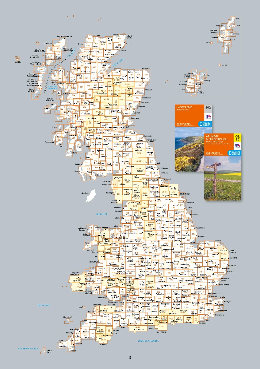
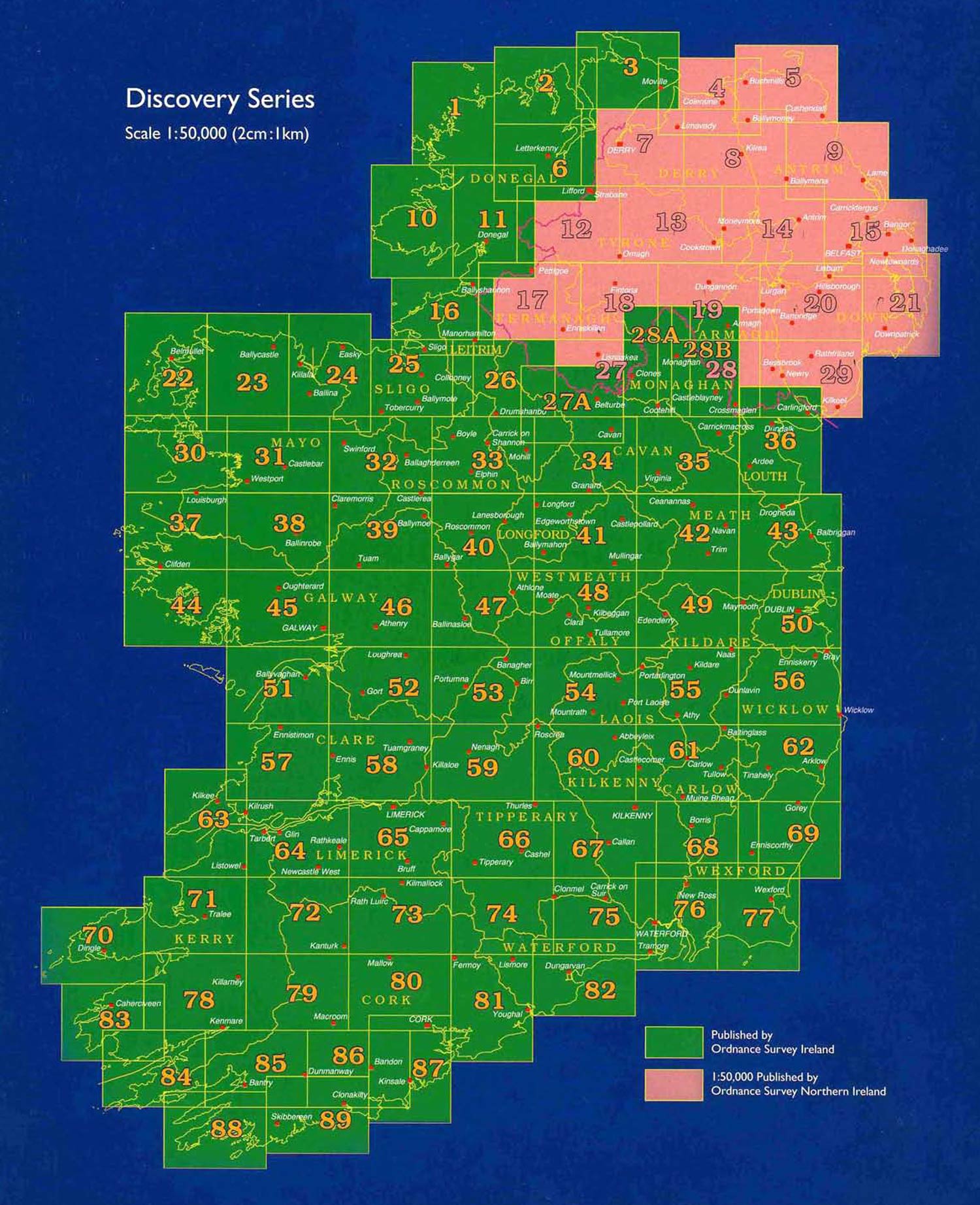
Ordnance Survey
Ordnance Survey Ireland / Ordnance Survey Northern Ireland
Go to Shop: Discovery Map 1:50.000
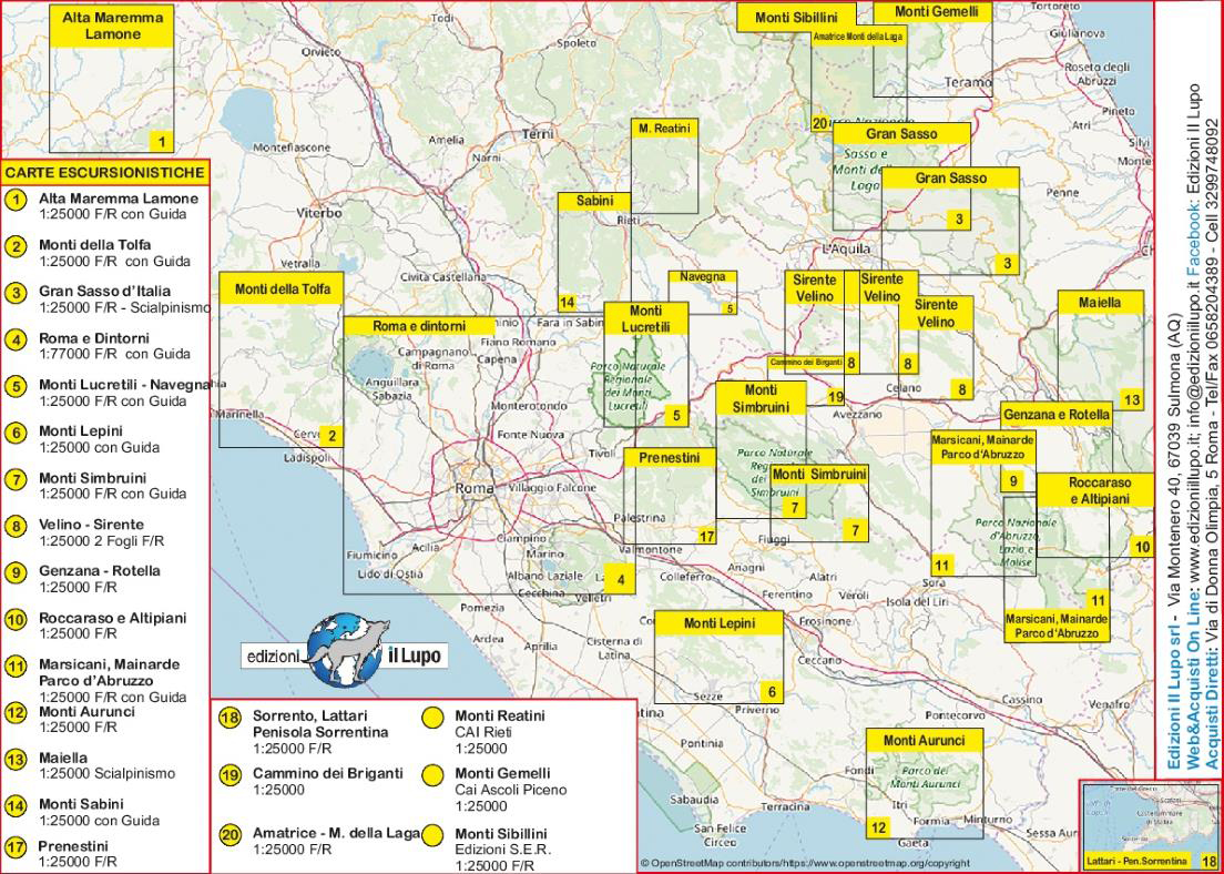
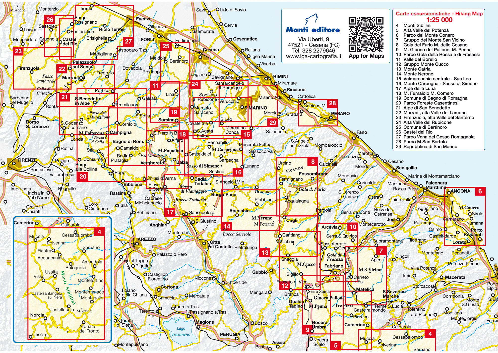
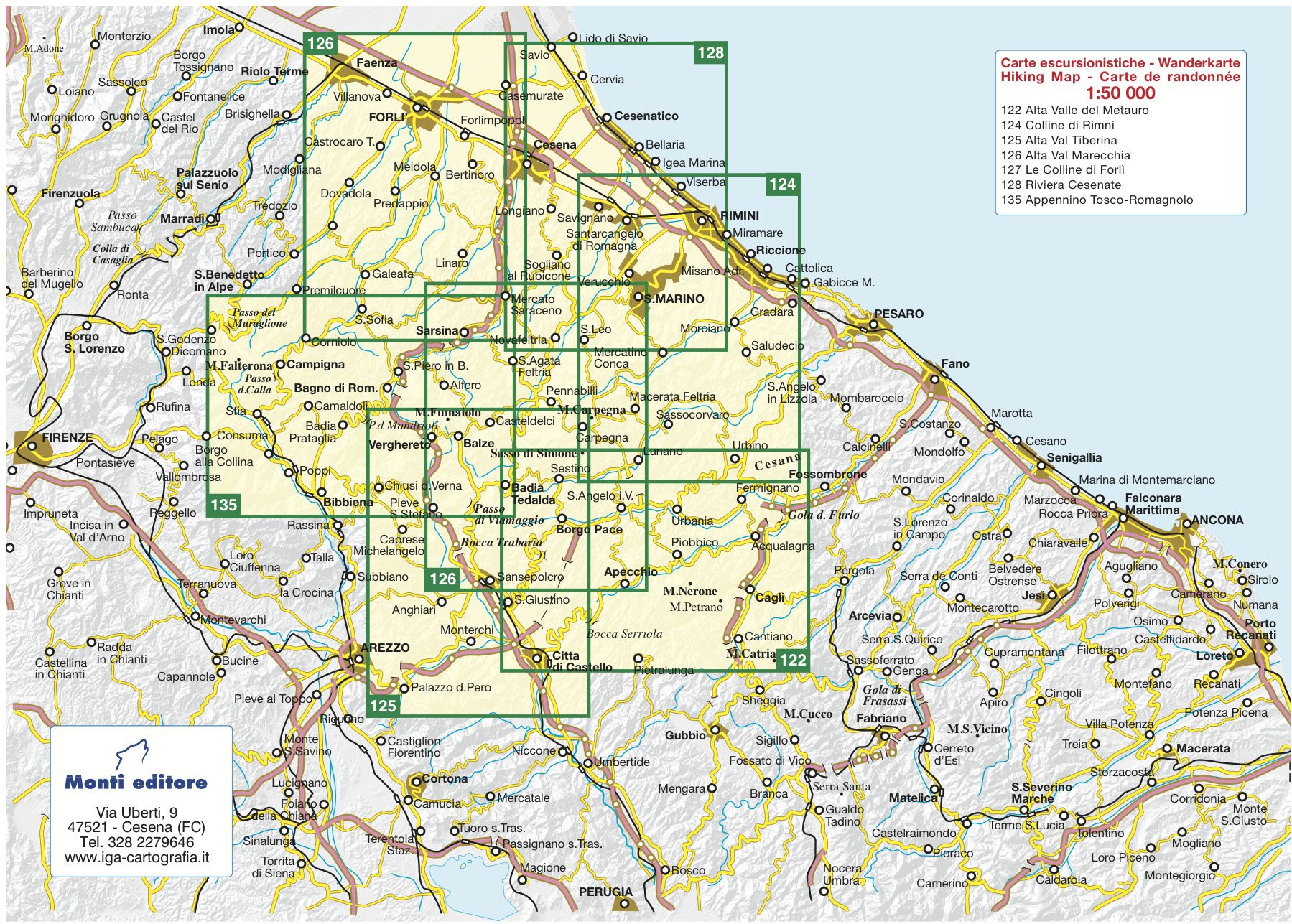
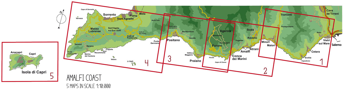
Tabacco
Friaul-Julisch Venetien, Lombardei, Südtirol, Trentino, Veneto
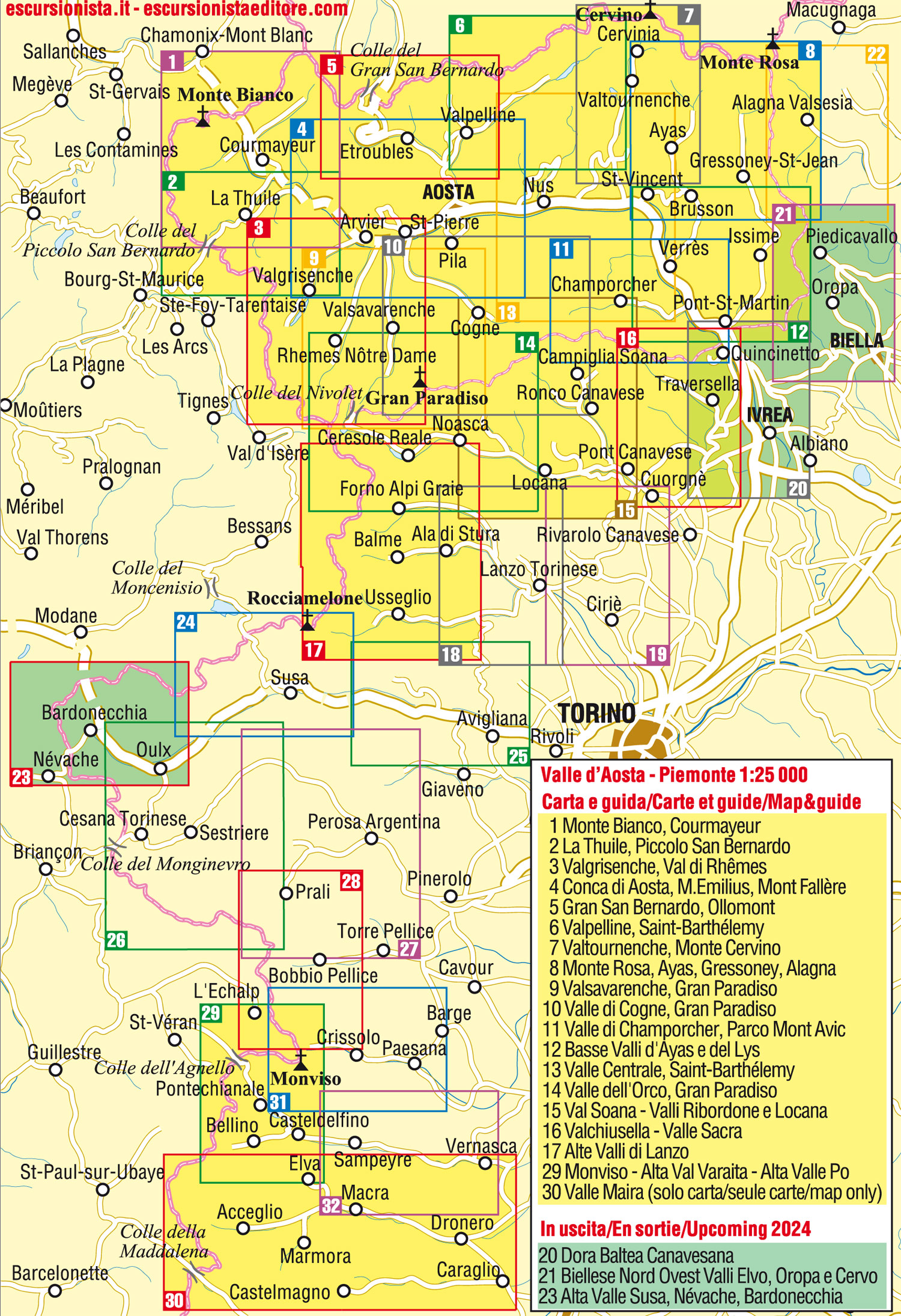
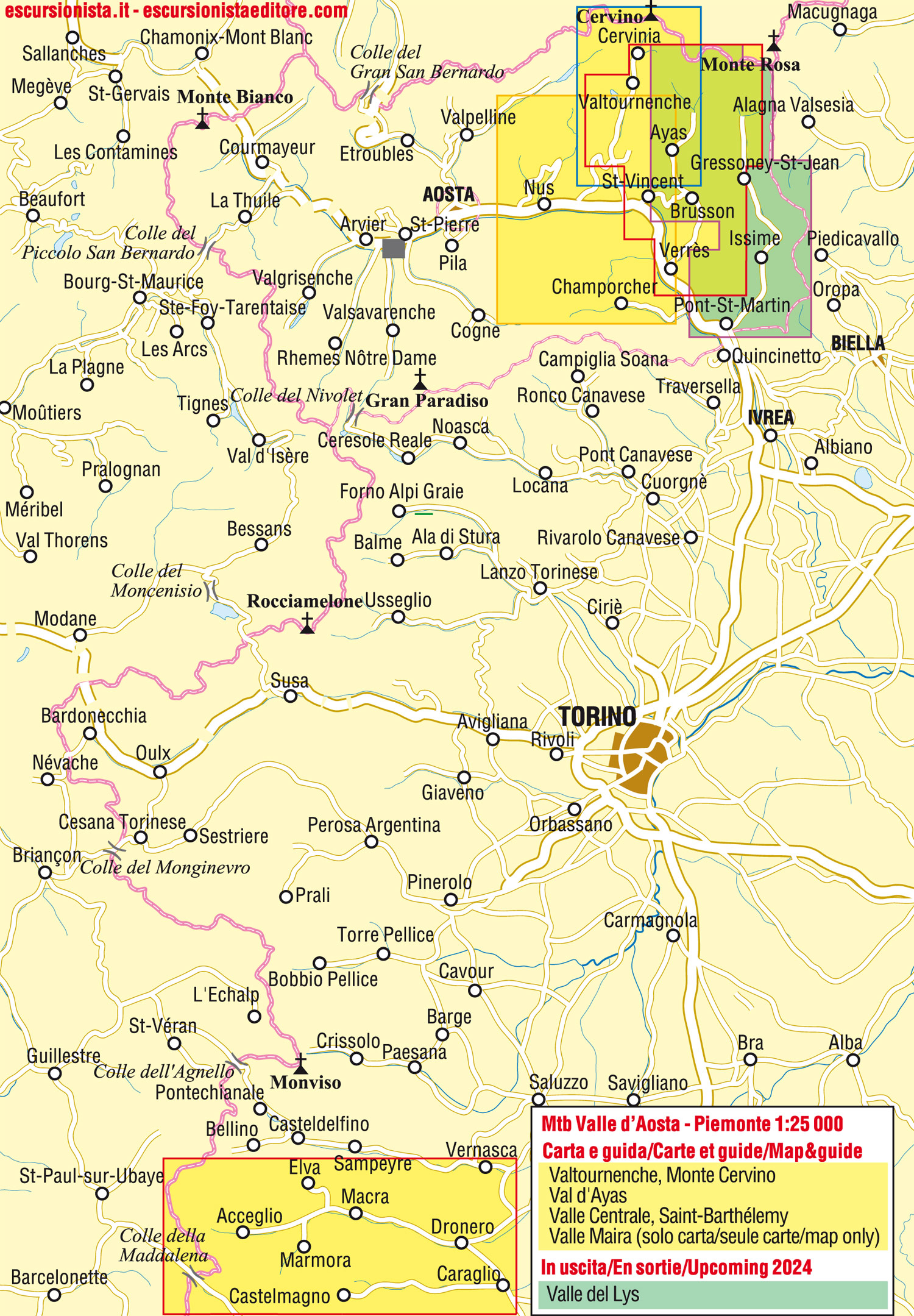


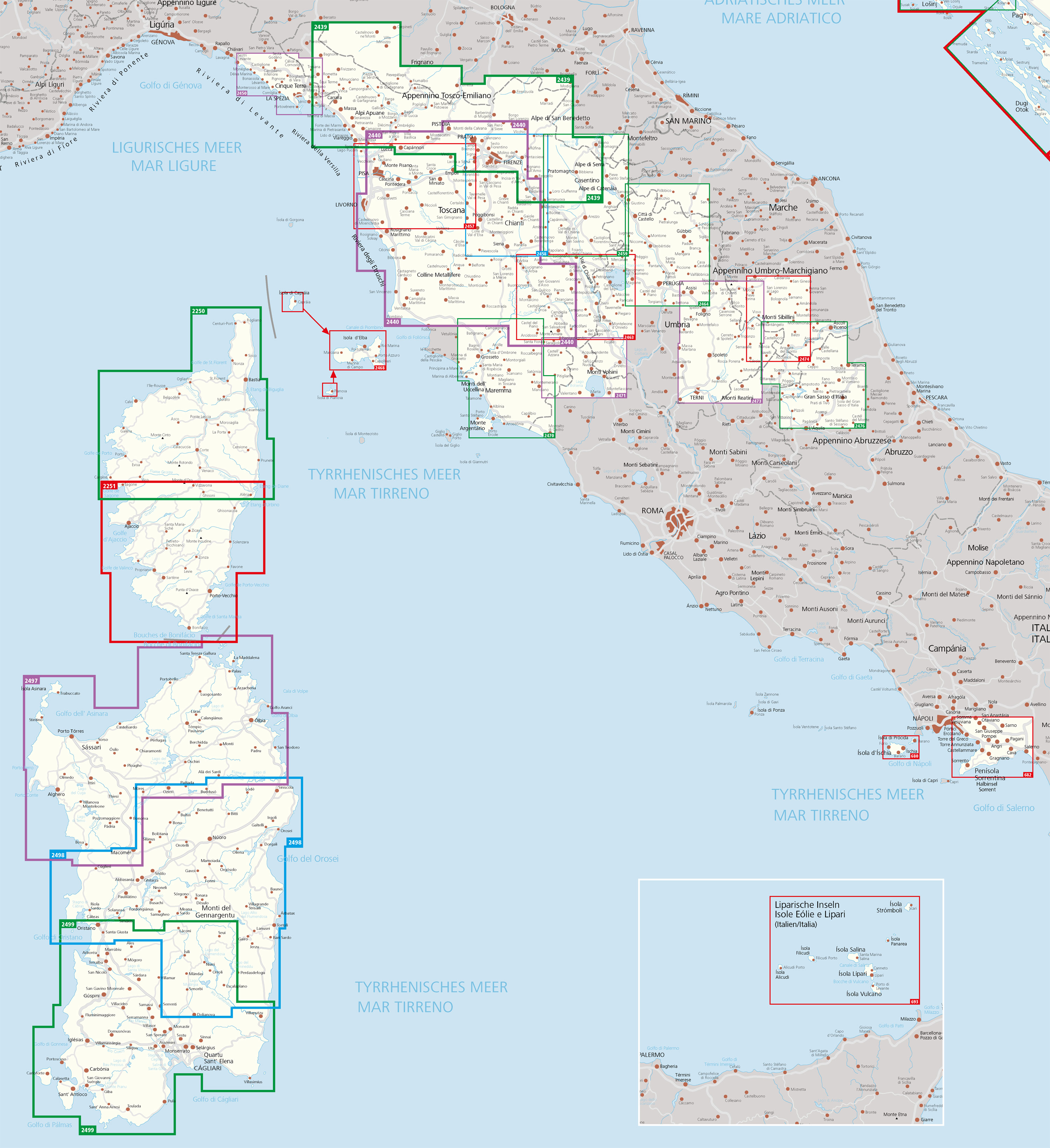
IGC - Istituto Geografico Centrale
Aostatal, Ligurien, Piemont
Go to Shop: Wanderkarten 1:50.000
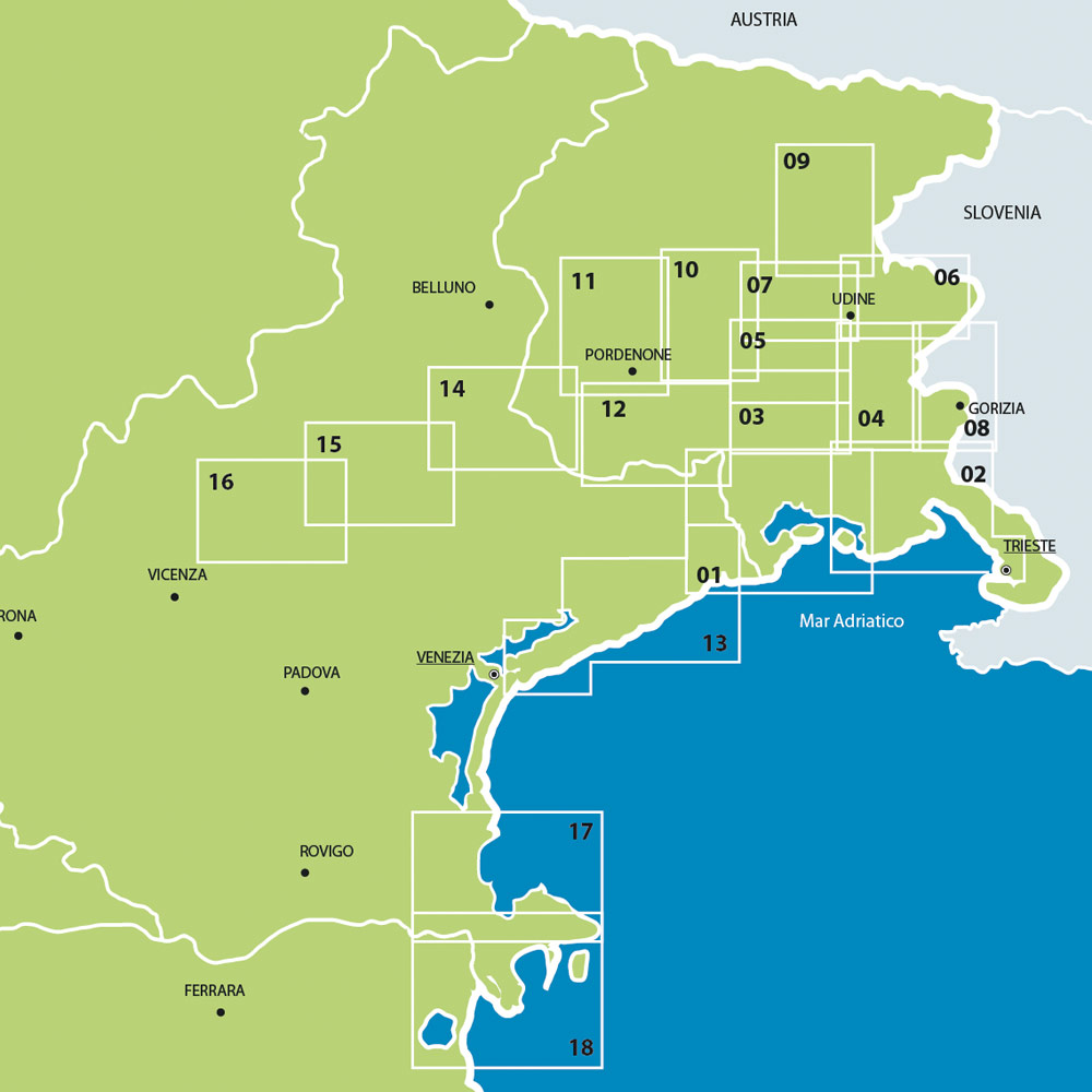
Odos
Friaul-Julisch Venetien, Veneto
Go to Shop: Wander-, Rad- und Reitkarten 1:25.000 – 1:35.000
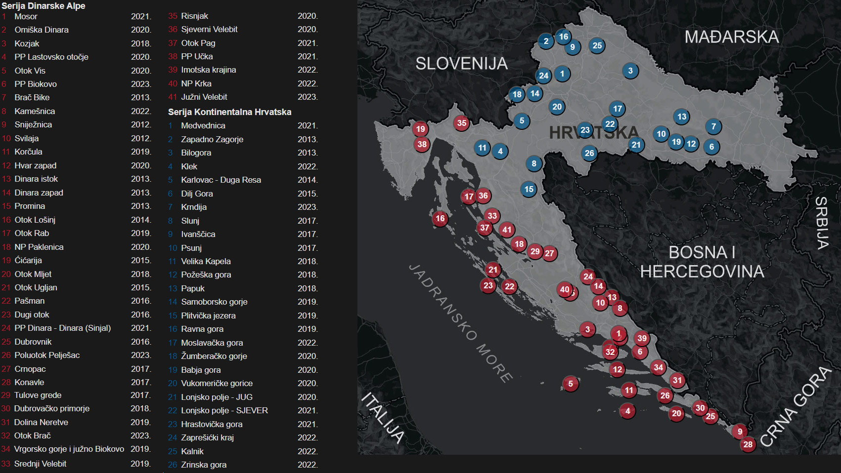
HGSS
Hrvatska Gorska Služba Spašavanja (Kroatischer Bergrettungsdienst)
Go to Shop: Wanderkarten 1:10.000 – 1:25.000


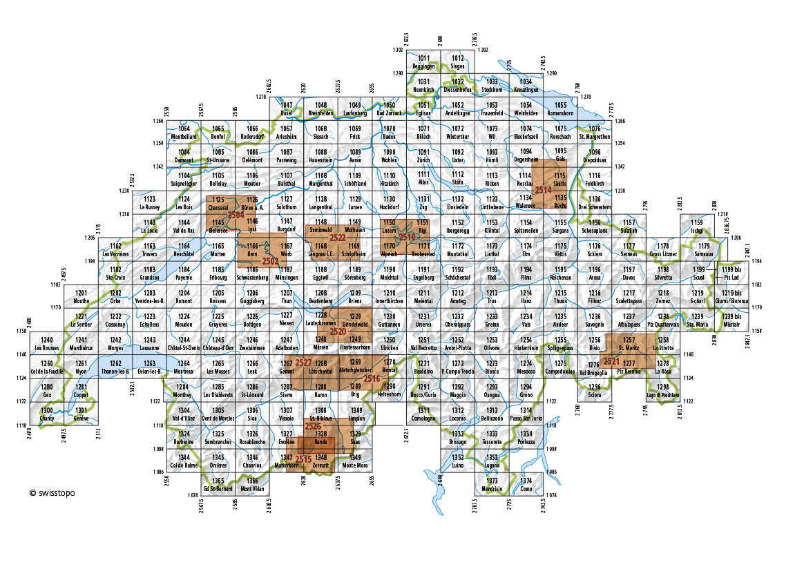
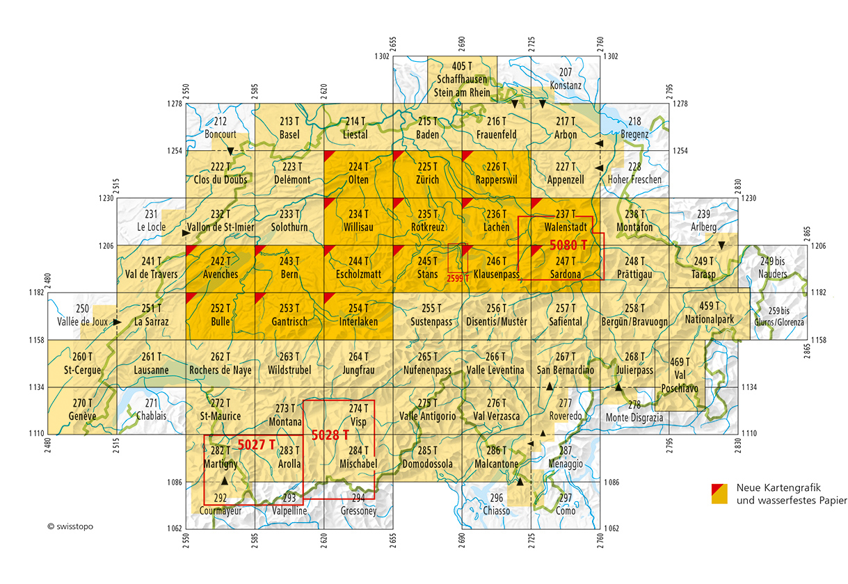
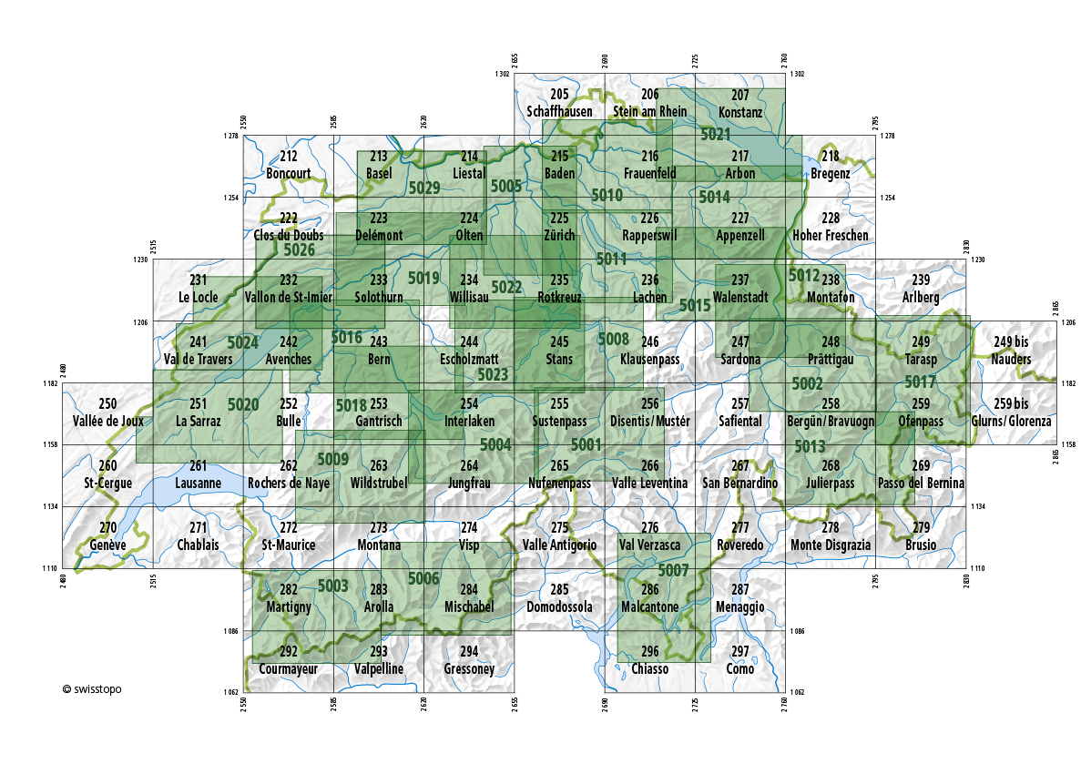
swisstopo - Bundesamt für Landestopografie
mit Liechtenstein

swisstopo - Bundesamt für Landestopografie
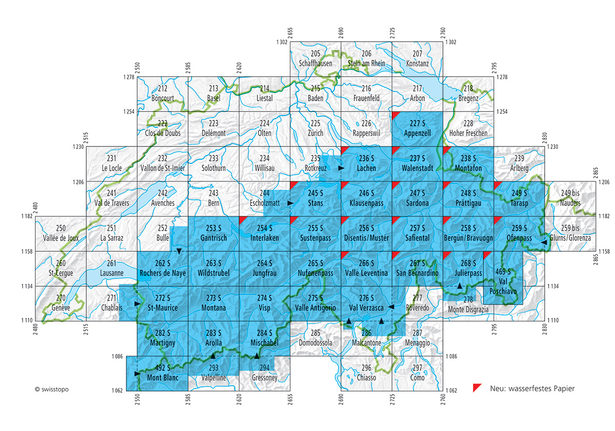
swisstopo - Bundesamt für Landestopografie
mit Liechtenstein und Mont Blanc-Massiv
Go to Shop: amtliche Wintersportkarten 1:50.000
swisstopo - Bundesamt für Landestopografie
mit Liechtenstein
swisstopo - Bundesamt für Landestopografie
mit Liechtenstein


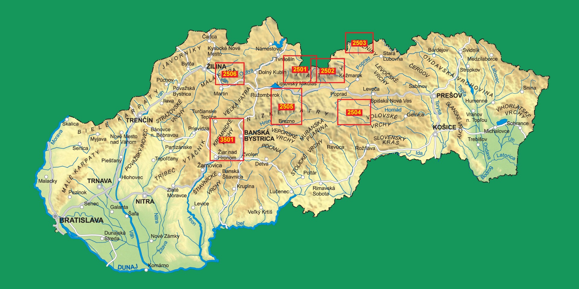

Planinska Zveza Slovenije
Slowenischer Alpenverein 1:50.000
Go to Shop: Wanderkarten 1:50.000
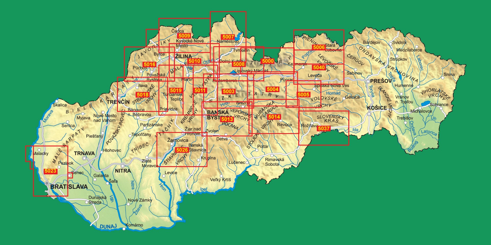
Planinska Zveza Slovenije
Slowenischer Alpenverein 1:25.000
Go to Shop: Wanderkarten 1:25.000

ICGC - Institut Cartogràfic i Geològic de Catalunya
Katalonien
Go to Shop: amtliche topografische Karten 1:50.000
ICGC - Institut Cartogràfic i Geològic de Catalunya
Katalonien, mit Andorra
Go to Shop: amtliche topografische Karten 1:100.000