The store will not work correctly when cookies are disabled.
JavaScript seems to be disabled in your browser. For the best experience on our site, be sure to turn on Javascript in your browser.
/
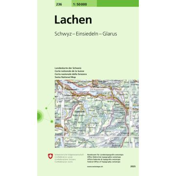
Schwyz - Einsiedeln - Glarus
236 Lachen /
Schwyz - Einsiedeln - Glarus
€13.95
incl. VAT
deliverable
Delivery in 7 to 14 business days
More from series: Landeskarte 1:50 000 Please select 212 Boncourt 213 Basel 1:50.000 214 Liestal 1:50.000 222 Clos du Doubs 223 Delémont 231 Le Locle 232 Vallon de St-Imier 1:50.000 233 Solothurn 238 Montafon 1:50.000 241 Val de Travers 1:50.000 250 Vallée de Joux 1:50.000 251 La Sarraz 1:50.000 275 Valle Antigorio 1:50.000 Appenzell 1:50.000 Arbon 1:50.000 Avenches 1:50.000 Baden 1:50.000 Bergün-Bravuogn 1:50.000 Bern 1:50.000 Bulle 1:50.000 Chiasso 1:50.000 Escholzmatt 1:50.000 Frauenfeld 1:50.000 Gantrisch 1:50.000 Geneve / Genf 1:50.000 Gressoney 1:50.000 Hoher Freschen 1:50.000 Interlaken 1:50.000 Klausenpass 1:50.000 Konstanz 1:50.000 Landeskarte der Schweiz Glorenza/Glurns 1:25.000 Landeskarte der Schweiz Nauders 1:50.000 Landeskarte der Schweiz Stein am Rhein Lausanne 1:50.000 Prättigau 1:50.000 Rapperswil 1:50.000 Rochers de Naye 1:50.000 Roveredo 1:50.000 Safiental 1:50.000 San Bernardino 1:50.000 Sardona 1:50.000 SLK 50 Bl.224 Schweiz - Olten 1:50.000 SLK 50 Bl.234 Schweiz - Willisau 1:50.000 SLK 50 Bl.235 Schweiz - Rotkreuz 1:50.000 SLK 50 Bl.245 Schweiz - Stans 1:50.000 SLK 50 Bl.256 Schweiz - Disentis/Muster 1:50.000 SLK 50 Bl.266 Schweiz - Valle Leventina 1:50.000 SLK 50 Bl.271 Schweiz/Frankreich - Chablais 1:50.000 SLK 50 Bl.272 Schweiz - St. Maurice 1:50.000 SLK 50 Bl.273 Schweiz - Montana 1:50.000 SLK 50 Bl.283 Schweiz - Arolla 1:50.000 SLK 50 Bl.286 Schweiz - Malcantone 1:50.000 St. Cergue 1:50.000 Sustenpass 1:50.000 Walenstadt 1:50.000 Wildstrubel 1:50.000 Zürich 1:50.000 Tags Map zentralschweiz suisse svizzera Switzerland Outdoor Einsiedeln Schwyz glarus Lachen 236 Klöntalersee Näfels Reichenburg Schwanden GL Sihlsee Wägitalersee
Manufacturer Name: Bundesamt für Landestopografie, swisstopo
Address: Seftigenstrasse 264, 3084 Wabern, Schweiz
Phone: 41,584,690,111
Responsible for the EU Name: Freytag-Berndt und Artaria KG
Address: Oelzeltgasse 3/10, 1030 Wien
Phone: +43 (1) 869 90 90
No manufacturer information and safety instructions available yet.
Payment
Reviews
If you are a reseller, please contact our
Wholesale departement directly.
Austria + Germany T.
+43-1-869 90 90-800 sales.at@freytagberndt.com
When ordering through our webshop, end-customer prices are applied and a subsequent correction is unfortunately not possible.
freytag & berndt Sales Team