The store will not work correctly when cookies are disabled.
JavaScript seems to be disabled in your browser. For the best experience on our site, be sure to turn on Javascript in your browser.
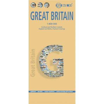
Great Britain, Großbritannien, Borch Map Great Britain, Großbritannien, Borch Map
England & Wales, Scotland & Northern Ireland, English Channel
Great Britain, Großbritannien, Borch Map England & Wales, Scotland & Northern Ireland, English Channel
€9.90
incl. VAT
deliverable
Delivery in 3 to 6 business days
More from series: Borch Maps Please select Amsterdam, Borch Map Argentina, Argentinien, Borch Map Aruba, Borch map Athens, Athen, Borch Map Bangkok, Borch Map Barcelona, Borch Map Belize, Borch Map Berlin, Borch Map Boston, Borch Map Brazil, Brasilien, Borch map Brussels, Brüssel, Borch Map Budapest, Borch Map Buenos Aires, Borch Map California, Kalifornien, Borch Map Cape Town, Kapstadt, Borch Map Chicago, Borch Map Chile, Borch Map Copenhagen, Kopenhagen, Borch Map Costa Rica, Borch Map Crete, Kreta, Borch Map Cuba, Kuba, Borch Map Dublin, Borch Map Ecuador, Borch Map Europe, Europa, Borch Map Florence, Florenz, Borch Map France, Frankreich, Borch Map Frankfurt am Main, Borch Map Germany, Deutschland, Borch Map Hamburg, Borch Map Hawaiian Islands, Hawaii, Borch Map Helsinki, Borch Map India North, Nordindien, Borch Map India South, Südindien, Borch Map Ireland, Irland, Borch Map Istanbul, Borch Map Italy, Italien, Borch Map Jerusalem, Borch Map Las Vegas, Borch Map Lisbon, Lissabon, Borch Map London, Borch Map Los Angeles, Borch Map Madrid, Borch Map Manhattan, Borch Map Miami, Borch Map Montreal, Montréal, Borch Map Moscow, Moskau, Borch Map Munich, München, Borch Map New Orleans, Borch Map New York City, Borch Map New Zealand, Neuseeland, Borch Map Northeast USA - New York & Great Lakes, Borch Map Northwest USA - Pacific Northwest, Borch Map Orlando, Borch Map Oslo, Borch Map Paris, Borch Map Peking, Beijing, Borch Map Peru, Borch Map Philadelphia, Borch Map Phoenix, Borch Map Prague, Prag, Borch Map Rome, Rom, Borch Map San Francisco, Borch Map Seattle, Borch Map Seychelles, Seychellen, Borch Map Singapore, Singapur, Borch Map Southeast USA - The South & Florida, Borch Map Southwest USA - American Southwest, Borch Map Spain, Spanien, Borch Map St. Petersburg, Sankt Petersburg, Borch Map Stockholm, Borch Map Switzerland, Schweiz, Borch Map Sydney, Borch Map Thailand, Borch Map Tokyo, Tokio, Borch Map Toronto, Borch Map Tuscany, Toskana, Borch Map USA Interstate, Borch Map Vancouver, Borch Map Venice, Venedig, Borch Map Vienna, Wien, Borch Map Virgin Islands, Jungferninseln (U.S. & British), Borch Map Washington D.C., Borch Map Yucatán, Yucatan, Borch Map Tags Großbritannien London Edinburgh Cardiff Wales Great Britain Bath Canterbury Stonehenge Loch Ness Scotland Northern Ireland Oxford Windsor york Lake District Cambridge The Cotswolds
Manufacturer Name: Borch GmbH
Address: Kollersberger Str. 44, 94051 Hauzenberg, Deutschland
Phone:
Responsible for the EU Name:
Address:
Email:
Phone:
No manufacturer information and safety instructions available yet.
Payment
Reviews
If you are a reseller, please contact our
Wholesale departement directly.
Austria + Germany T.
+43-1-869 90 90-800 sales.at@freytagberndt.com
When ordering through our webshop, end-customer prices are applied and a subsequent correction is unfortunately not possible.
freytag & berndt Sales Team