Anavasi Topo Island Map 10.52, Sámos 1:70.000
Östliche Ägäis
€9.90
incl. VAT
deliverable
Delivery in 7 to 14 business days
Tags
100cm x 70cm
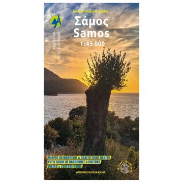
Walking Map of Samos on a scale of 1:45.000 The first map of Anavasi for Samos was realized in collaboration with the Planning Department for Landscape Enhancement and Communication Sciences, University of Bordeaux, France as well as the Samos Fire Service. Through field research, cultural, archaeological and oenological hiking routes were recorded. The map of Samos includes all the information that the hiker and the traveler will need on the island of "Pythagoras". Specifically, 32 marked hiking routes and 8 proposed hiking routes are recorded. The map of Samos includes all the information that the hiker and the traveler will need on the island of "Pythagoras". Specifically, 32 marked hiking routes and 8 proposed hiking routes are recorded. All suggested hiking routes are marked with a separate color on the map. On the back you will find detailed information about the 8 routes in English, Greek and French. Printed on waterproof PolyArt paper
Walking Map of Samos on a scale of 1:45.000 The first map of Anavasi for Samos was realized in collaboration with the Planning Department for Landscape Enhancement and Communication Sciences, University of Bordeaux, France as well as the Samos Fire Service. Through field research, cultural, archaeological and oenological hiking routes were recorded. The map of Samos includes all the information that the hiker and the traveler will need on the island of "Pythagoras". Specifically, 32 marked hiking routes and 8 proposed hiking routes are recorded. The map of Samos includes all the information that the hiker and the traveler will need on the island of "Pythagoras". Specifically, 32 marked hiking routes and 8 proposed hiking routes are recorded. All suggested hiking routes are marked with a separate color on the map. On the back you will find detailed information about the 8 routes in English, Greek and French. Printed on waterproof PolyArt paper
Weight:
70 g
Publisher:
Series:
Scale:
1:45.000
Product Type:
Maps
Language:
English, French, Modern Greek
EAN:
9786185823016
hoehe_mm_offen:
700
Year of publication:
2024
Write Your Own Review
Manufacturer
Name:
Address:
Email:
Phone:
Responsible for the EU
Name:
Address:
Email:
Phone:
Hazard warning:
Product Type: