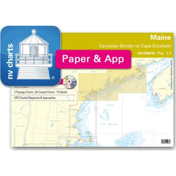
NV-Charts Reg. 1.1 - Maine, Canadian Border to Cape Elizabeth
inkl. CD

Practical to use and accurate in the information and data published: This is the basic concept with which we have developed the nv-charts. •• this Chart Kit is based on NOAA data with a new layout, clear cartography and international chart standards
•• depths and heights are charted in feet
•• north up chart orientation
•• channel markers in red and green
•• unique color differences, blue for the 6 ft and 18 ft dephts, and green for exposed tidal areas
•• contour lines for 12 ft and 30ft depths
•• under water reefs are clearly marked with a light green color and the reef above water in darker green
•• variable shoals marked in grey-blue
•• lighthouses illustrate their light characteristics for better identification
•• seaworthy chart layout - perfect chart flow from one chart to the next
•• standardized chart scales - passage charts 1:340,000 – coastal charts 1:45,000 and detail charts 1:25,000 or less
•• waypoints with latitudes and longitudes for GPS input
•• recommended courses with distances
•• arrow-symbols show buoyage direction
•• tide information on each chart
Passage Charts
C1 Gulf of Maine 1: 1,300,000
C2 Canadian Border to Mount Desert Island 1: 340,000
C3 Mount Desert Island to Portland 1: 340,000
Coastal Charts and Details
C4 Grand Manan Channel 1: 80,000
C5 Cutler to Head Harbor I. 1: 80,000
C6 Head Harbor I. to Petit Manan I. 1: 80,000
C7 Petit Manan I. to Duck I. 1: 80,000
C8 Duck I. to Isle au Haut 1: 80,000
C9 Penobscot Bay Approaches 1: 80,000
C11 East & West Penobscot Bay 1: 80,000
C12 Monhegan I. to Seguin Island 1: 80,000
C13 Seguin Island to Cape Elizabeth 1: 80,000
C14 Southeast Approach to Passamaquoddy Bay 1: 50,000
C15 St.Croix River & Passamaquoddy Bay 1: 50,000
C16 Eastport and Surrounding Waters 1: 50,000
C16A Eastport Harbor 1: 5,000
C17 Bay of Fundy 1: 50,000
C18 Grand Manan Island · North 1: 50,000
C19 Grand Manan Island · Southeast 1: 50,000
C20 Grand Manan Channel 1: 50,000
C21 Grand Manan Southern Head 1: 50,000
C22 Grand Manan Channel · South 1: 50,000
C23 Machias Bay 1: 40,000
C24 Englishman Bay 1: 40,000
C25 Western Bay 1: 40,000
C26 Pleasant Bay · South 1: 40,000
C27 Pleasant Bay · North 1: 40,000
C28 Gouldsboro Bay 1: 40,000
C29 Mount Desert Island SE 1: 40,000
C30 Bar Harbor 1: 40,000
C31 Frenchman Bay · North 1: 40,000
C32 Union River Bay 1: 40,000
C33 Blue Hill Bay 1: 40,000
C34 Eggemoggin Reach 1: 40,000
C34A Blue Hill Harbor 1: 20,000
C35 Mt. Desert Island · South 1: 40,000
C36 Jericho Bay 1: 40,000
C37 Isle au Haut 1: 40,000
C38 East Penobscot Bay 1: 40,000
C39 Penobscot Bay Entrance 1: 40,000
C40 West Penobscot Bay · South 1: 40,000
C41 East Penobscot Bay 1: 40,000
C42A Eggemoggin Reach · West 1: 40,000
C42B Continuation to Bangor 1: 40,000
C43 Isleboro Island 1: 40,000
C44 Penobscot Bay · North 1: 40,000
C45A Penobscot River 1: 40,000
C45B Bagaduce River 1: 40,000
C46 Matinicus Island 1: 40,000
C47 Penobscot Bay Southwest Approach 1: 40,000
C48 Georges Islands 1: 40,000
C49 Medomak & St. Georges Rivers 1: 40,000
C50A Monhegan I. 1: 40,000
C50B Muscongus Bay 1: 40,000
C51 Damariscotta & Medomak Rivers 1: 40,000
C52 Boothbay Approach 1: 40,000
C53 Kennebec & Sheepscot Rivers 1: 40,000
C55 Cape Small to Halfway Rock 1: 40,000
C56 Harpswell Neck Vicinity 1: 40,000
C57 Broad Sound to Yarmouth 1: 40,000
C58 Portland Hbr. Approaches 1: 40,000
C59 Winter Harbor 1: 10,000
C60 Southwest Harbor 1: 10,000
C61A Cranberry Harbor 1: 10,000
C61B Casco Passage 1: 20,000
C62 Deer Island Thorofare · East 1: 20,000
C63 Deer Island Thorofare 1: 20,000
C64 Fox Islands Thorofare 1: 15,000
C65A Boothbay Harbor 1: 15,000
C65B Winter Hbr & Seal Bay 1: 15,000
C66A Camden and Rockport Harbor 1: 20,000
C66B Rockland Harbor 1: 20,000
C67B Christmas Cove 1: 10,000
C67C New Harbor 1: 10,000
C67D Carvers Harbor & Approaches 1: 15,000
C67E Thomaston 1: 10,000
C68 Portland Hbr and Vicinity 1: 20,000
Produktdetails:
EAN: 9995341200800
Verlag:
Reihe:
Medienart:
Seekarten - plano
EAN:
9995341200800
Erscheinungsjahr:
2018
Kategorien: Seekarten