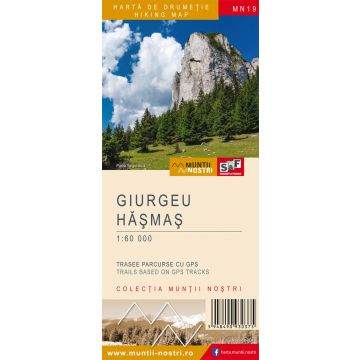
Wanderkarte MN-19, Giurgeu, Hășmaș 1:60.000
Ostkarpaten

Tags
The Giurgeu - Hasmas Mountains are two neighboring mountains, with the following bounderies: Bilbor Depression and Bistricioara Valley to the north; Pintic and Bistra valleys (separating them from Ceahlau Massif), Damuc and Poiana Fagului valleys (separating them from Tarcau Mountains) to the east; Tarcau Saddle (where they border Ciuc Mountains), Upper Ciuc Depression, Gretes Pass (where they border Harghita Mountains) to the south; Giurgeu Depression and Toplita, Lomas and Voivodeasa valleys (separating them from Calimani Mountains) to the west. The boundary between the two massifs is represented by a series of north-south valleys: Putna Valley, Putna Intunecoasa Valley, Pangarati Pass, Medias Valley and the Olt River.
The difference between the two massifs lies in their geology, which results in different landforms. The Giurgeu consists of crystalline rocks (crystalline shale) and to a smaller extent by igneous rocks (Ditrau Sienite), resulting in long ridges and rounded peaks, few reaching elevations above 1,500 m. The highest peaks are Sipos (1,568 m), Prisca (1,544 m), Arama Neagra (1,538 m).
The Hasmas consists of sedimentary rocks (limestone - dolomite) deposited on a suspended syncline with crystalline shale foundation, so there are large rocky areas (the rocky walls of Hasmasul Mare Peak), solitary rocks (Piatra Singuratica, Piatra Altarului), gorge sections (Bicaz Gorge, Bicajel Gorge, Sugau Gorge). The highest peaks are Hasmasul Mare (1,792 m), Hasmasul Negru (1,773 m), Piatra Ascuita (1,707 m), Vithovos (1,609 m).
Giurgeu - Hasmas Mountains are home to several natural attractions such as: the Red Lake (natural dam lake), Bicaz Gorge, Sugau Gorge, Borsec town with mineral water springs, the sources of the two major rivers in Romania: the Olt and the Mures.
The map of Giurgeu - Hasmas Mountains (MN19) is the 19th map of the new Muntii Nostri collection.
The map was edited using the latest mapping techniques and it was printed on moisture resistant paper. It is easy to read and simple to use due to the mapping styles, specific to Schubert & Franzke company, and as a result of practical information structuring. It is handy and everything is exactly where it should be. The map is useful for both hiking enthusiasts and professionals.
The Lacul Rosu area and the Borsec area was digitized at a more detailed scale: 1 : 35000 and 1 : 20000.
All the trails have been recorded in the field using a GPS. They are described in detail in both Romanian and English, some trails having representative images attached to them. Each trail has a technical box containing: trail marking checked in the field, trail route, profile with major landmarks, data on difficulty, length, total ascent, total descent, round-trip time, practicability depending on the season and so on. The map also contains the UTM grid, a projected coordinate metric system useful in the quick measurement of distances on the map. Shading and contour lines highlight the landscape and facilitate orientation.
Reihe:
Maßstab:
1:60.000
Medienart:
Karten
Sprache:
Englisch, Rumänisch
EAN:
5948490930375
Erscheinungsjahr:
2018