Radwanderkarte von Dänemark 1:500.000
mit Kopenhagen im Maßstab 1:35.000

Tags
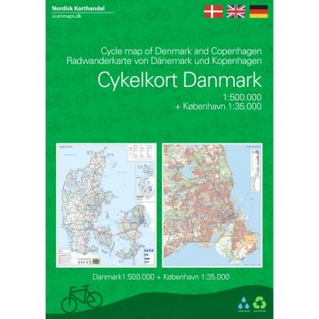
4. edition of Nordisk Korthandel's cyclemap of Denmark is now including a cycle map of Copenhagen in scale 1:35.000, which can help finding your way in the capitol.
The map of Denmark contains vitale information for cycling touring in Denmark. It contains national and regional cycle routes, cycle paths, hostels, campsites, tourist information etc., and there is a Eurovelo map showing international bicycle routes in Denmark. Information about danish traffic rules for bicycling is included. There are more than 160 regional and 11 national cycle routes on the map, and new routes like Kulturringen (East Jutland) and Vestegnsruten (Copenhagen) are included.
The Cycle Map is a planning map, giving an overview of the possibilities for bicyclists.
On the other side of the map you have a map of Copenhagen in scale 1:35.000, which gives a detailed view of cycle paths and routes in Copenhagen.
The Copenhagen map contains:
- National cycle routes 2, 4, 6 and 9
- Supercycle routes 77, 82, 84, 93, 94, 95, 97 and 99
- Regional cycle routes Mølleådalen, Vestegnsruten, 31, 50, 51, 52, 53, 57, 58, 60, 62, 65, 67, 69, 73, 80 and 84
- Locale cycle routes Strandparkruten, Familieruten, Parkruten, Liljeruten, Kilderuten, Skt. Jacobruten, Søruten, Skovruten and Havneringen
- General information about accomodation, bicycle inclusion on trains etc.
- Information icons on convenience stores, bicycle stores, national attractions, tourist agencies, camping sites, tent camps, hostels, beaches and bicycle friendly churches. /li>Cycle paths with road names
Weight:
104 g
Publisher:
Scale:
1:500.000
Product Type:
Maps
Language:
Danish, English, German
EAN:
9788779671706
Year of publication:
2021
Continent: Europe
Country: Denmark
Region: Fünen, Jütland, Öresund, Lolland, Falster, Danish North Sea Coast, Sjælland, Kattegat, Skagerrak, Dänische Ostseeinseln
Categories: Cycling Guides, Cycling Maps
